Posted on

Vessel Traffic Service (VTS)

How do VTS contribute to safety of life at sea?

VESSEL TRAFFIC SERVICE (VTS):- A vessel traffic service (VTS) is a marine traffic monitoring system established by harbour or port authorities, similar to air traffic control for aircraft. Typical VTS systems use radar, closed-circuit television (CCTV), VHF radiotelephony and automatic identification system to keep track of vessel movements and provide navigational safety in a limited geographical area

SOLAS CHAPTER V – REGULATION 12 – Vessel traffic services:-

  1. Vessel traffic services (VTS) contribute to safety of life at sea, safety and efficiency of navigation and protection of the marine environment, adjacent shore areas, work sites and offshore installations from possible adverse effects of maritime traffic.
  2. Contracting Governments undertake to arrange for the establishment of VTS where, in their opinion, the volume of traffic or the degree of risk justifies such services.
  3. Contracting Governments planning and implementing VTS shall, wherever possible, follow the guidelines developed by the Organization*. The use of VTS may only be made mandatory in sea areas within the territorial seas of a coastal State.
  4. Contracting Governments shall endeavor to secure the participation in, and compliance with, the provisions of vessel traffic services by ships entitled to fly their flag.
  5. Nothing in this regulation or the guidelines adopted by the Organization shall prejudice the rights and duties of Governments under international law or the legal regimes of straits used for international navigation and archipelagic sea lanes.

Benefits of implementing a VTS

The purpose of VTS is to improve the maritime safety and efficiency of navigation, safety of life at sea and the protection of the marine environment and/or the adjacent shore area, work sites and offshore installations from possible adverse effects of maritime traffic in a given area. VTS may also have a role to play in security.

The benefits of implementing a VTS:-

  • It allows identification and monitoring of vessels, strategic planning of vessel movements and provision of navigational information and navigational assistance.
  • It can assist in reducing the risk of pollution and, should it occur, coordinating the pollution response. Many authorities express difficulty in establishing justifiable criteria for identifying whether VTS is the most appropriate tool to improve the safety and efficiency of navigation, safety of life and the protection of the environment.
  • A VTS is generally appropriate in areas that may include any, or a combination, of the following:
    • high traffic density;
    • traffic carrying hazardous cargoes;
    • conflicting and complex navigation patterns;
    • difficult hydrographical, hydrological and meteorological elements;
    • shifting shoals and other local hazards and environmental considerations;
    • interference by vessel traffic with other waterborne activities;
    • number of casualties in an area during a specified period;
    • existing or planned vessel traffic services on adjacent waterways and the need for cooperation between neighbouring states, if appropriate;
    • narrow channels, port configuration, bridges, locks, bends and similar areas where the progress of vessels may be restricted; and
    • existing or foreseeable changes in the traffic pattern in the area.

Objectives of VTS:

  1. The purpose of vessel traffic services is to improve the safety and efficiency of navigation, safety of life at sea and the protection of the marine environment and/or the adjacent shore area, worksites and offshore installations from possible adverse effects of maritime traffic.
  2. A clear distinction may need to be made between a Port or Harbour VTS and a Coastal VTS. A Port VTS is mainly concerned with vessel traffic to and from a port or harbour or harbours, while a Coastal VTS is mainly concerned with vessel traffic passing through the area. A VTS could also be a combination of both types. The type and level of service or services rendered could differ between both types of VTS; in a Port or Harbour VTS a navigational assistance service and/or a traffic organization service is usually provided for, while in a Coastal VTS usually only an information service is rendered.
  3. The benefits of implementing a VTS are that it allows identification and monitoring of vessels, strategic planning of vessel movements and provision of navigational information and assistance. It can also assist in prevention of pollution and co-ordination of pollution response. The efficiency of a VTS will depend on the reliability and continuity of communications and on the ability to provide good and unambiguous information. The quality of accident prevention measures will depend on the system’s capability of detecting a developing dangerous situation and on the ability to give timely warning of such dangers.
  4. The precise objective of any vessel traffic service will depend upon the particular circumstances in the VTS area and the volume and character of maritime traffic as set forth in 3.2 of these Guidelines and Criteria.

Use of VTS in navigation:

  • Automatic Identification System (AIS) is a system that makes it possible to monitor and track ships from suitably equipped ships, and shore stations. AIS transmissions consist of bursts of digital data ‘packets’ from individual stations, according to a pre-determined time sequence.
  • AIS makes navigation safer by enhancing situational awareness and increases the possibility of detecting other ships, even if they are behind a bend in a channel or river or behind an island in an archipelago.
  • AIS can also solve the problem inherent with radars, by detecting smaller craft, fitted with AIS, in sea and rain clutter.

Reporting procedures of VTS and SRS:

Reporting procedures of VTS and SRS:- Standard Reporting Procedures, IMO Resolution A.851 (20) – ‘General Principles for Ship Reporting Systems and Ship Reporting Requirements’.

Types of Communication Messages and Message Markers:-

  • To facilitate shore-to-ship and ship-to-shore communication in a VTS environment, one of the following eight message markers should be used to increase the probability of the purpose of the message being properly understood.
  • It is at the discretion of the shore personnel or the ship’s officer whether to use one of the message markers and, if so, which marker is applicable to the situation.
  • If used, the message marker is to be spoken preceding the message or the corresponding part of the message.
  • The contents of all messages directed to a vessel should be clear; IMO Standard Marine Communication Phrases should be used where practicable.

Elements of the Ship’s Routeing System:

The objective of ships’ routeing is to “improve the safety of navigation in converging areas and in areas where the density of traffic is great or where freedom of movement of shipping is inhibited by restricted sea room, the existence of obstructions to navigation, limited depths or unfavourable meteorological conditions”. Ships routeing systems can be established to improve safety of life at sea, safety and efficiency of navigation, and/or increase the protection of the marine environment.

Elements used in traffic routeing systems include:

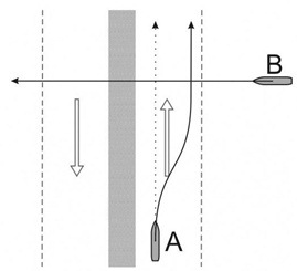
  • Traffic separation scheme: a routeing measure aimed at the separation of opposing streams of traffic by appropriate means and by the establishment of traffic lanes.
  • Traffic lane: an areas within defined limits in which one-way traffic is established, natural obstacles, including those forming separation zones, may constitute a boundary.
  • Separation zone or line: a zone or line separating traffic lanes in which ships are proceeding in opposite or nearly opposite directions; or separating a traffic lane from the adjacent sea area; or separating traffic lanes designated for particular classes of ship proceeding in the same direction.
  • Roundabout: a separation point or circular separation zone and a circular traffic lane within defined limits.
  • Inshore traffic zone: a designated area between the landward boundary of a traffic separation scheme and the adjacent coast.
  • Recommended route: a route of undefined width, for the convenience of ships in transit, which is often marked by centreline buoys.
  • Deep-water route: a route within defined limits which has been accurately surveyed for clearance of sea bottom and submerged articles.
  • Precautionary area: an area within defined limits where ships must navigate with particular caution and within which the direction of flow of traffic may be recommended.
  • Area to be avoided: an area within defined limits in which either navigation is particularly hazardous or it is exceptionally important to avoid casualties and which should be avoided by all ships, or by certain classes of ships.

Before Implementing or starting a TSS or Vessel routeing system the below mentioned information should be collected:

  1. Data about the area and problem or threat thereof:
    • Resources within are
    • Potential navigation hazard.
    • Environmental factors
  2. Data about the ship traffic (e.g., vol., traffic patterns)
  3. Information regarding existing measures
  4. Foreseeable changes in traffic patterns
  5. Information regarding incident history
  6. Existing aids to navigation
  7. Charts (are they up to date?)
  8. IMO documents (models)


VTS Category – Information Service:

Defined by IMO as ‘a service to ensure that essential information becomes available in time for on-board navigational decision-making’. The information service comprises broadcasts of information at fixed times or when deemed necessary by the VTS Authority or at the request of a vessel, and may include for example :

  1. Reports on the position, identity and intentions of other traffic;
  2. Waterway conditions;
  3. Weather;
  4. Navigational hazards;
  5. Any other factors that may influence the vessel’s transit.

Navigational Assistance Service: Defined by IMO as ‘a service to assist on-board navigational decision-making and to monitor its effects, especially in difficult navigational or meteorological circumstance or in case of defect or deficiencies.’ There may be occasions when an increased or new risk makes it appropriate to enhance the service through the additional provision of a Navigational Assistance Service. The IMO Resolution explains the key tenets of this service as:

  1. A service that is intended to assist in the navigational decision making process on board and to monitor its effects.
  2. Particularly relevant to:
    • Difficult navigational circumstances;
    • Difficult meteorological conditions;
    • Vessel defects or deficiencies.
  3. A service that is rendered at the specific request of a vessel or by a VTS Authority when deemed necessary.
  4. A service that is provided only on specified occasions and under clearly defined circumstances.
  5. The beginning and end of navigational assistance should be clearly stated by the vessel or the VTS and acknowledged by the other party.

The IALA VTS Manual indicates that Navigational Assistance Service can fall into one of two categories, depending on whether navigational information or advice is given. Navigational Assistance Service consisting only of the giving of navigational information is referred to in this guidance as Contributory. Navigational Assistance Service consisting of the giving of navigational advice as well as navigational information is referred to as Participatory. The definitions, particularly of the Participatory service, are open to interpretation and for the avoidance of doubt their meaning is refined and expanded as follows.

  1. Contributory Navigational Assistance Services:

A Contributory Navigational Assistance Service is solely the provision of factual navigational information to assist the on-board decision making process.

The information is provided either in response to a specific request from a vessel or when the VTS Authority perceives that the information would be of use to the vessel.

A Contributory Navigational Assistance Service may include information on :

  1. Courses and speeds made good;
  2. Positions relative to fairway axis and waypoints;
  3. Positions, identities and intentions of surrounding traffic;
  4. Warnings of dangers.
  1. Participatory Navigational Assistance Service:

In a Participatory Navigational Assistance Service, the VTS can become involved in the on-board decision making process by providing navigational advice. Through the exchange of information between vessel and VTS, an agreed course of action may emerge. However, any recommendations from the VTS must be result orientated and must not include specific instructions on courses to steer and speed through the water. As with the Contributory service, it is provided on specific request or when perceived necessary by the VTS Authority, in the interests of safety.

Dependent on the complexity of the situation and the level of risk mitigation required, consideration should be given to the following :

(1) Authorisations of operators providing the service and recording of such authorisations;

(2) The need to reflect this category of service in the On the Job Training of VTS Operators;

(3) Operator work load during Participatory Navigational Assistance Service, including other responsibilities and activities, and the number of vessels being monitored or advised;

(4) Use of a discrete frequency;

(5) Increased traffic restrictions;

(6) The requirements of the Pilotage Act 1987.

Traffic Organisation Service: Defined by IMO as ‘a service to prevent the development of dangerous maritime traffic situations and to provide for the safe and efficient movement of vessel traffic within the VTS Area.’

The provision of a Traffic Organisation Service includes a comprehensive and dedicated service, throughout the declared service period, without which the long term planning of traffic movement and developing situation would not be possible. This service is, by its nature, more comprehensive than an Information Service, the capability of which it necessarily includes.

Where the risks identified through the formal risk assessment are such that the only appropriate mitigating measure is the provision of service that monitors vessel traffic movement and enforces adherence to governing rule and regulation, a Traffic Organisation Service should be considered appropriate.

A Traffic Organisation Service is concerned with, for example :

  1. Forward planning of vessel movements;
  2. Congestion and dangerous situations;
  3. The movement of special transports;
  4. Traffic clearance systems;
  5. VTS sailing plans;
  6. Routes to be followed;
  7. Adherence to governing rules and regulations.

Instructions given as part of a Traffic Organisation Service shall be result orientated, leaving the details of the execution to the vessel.

Posted on

Bridge Resource Management on Ships

Bridge Resource Management  & Bridge Team Management:

Situational Awareness and the conditions that affect Situational awareness of an OOW as per BRM:

  • BRM (Bridge Resource Management) addresses the management of operational tasks, as well as stress, attitudes and risk. BRM recognizes there are many elements of job effectiveness and safety, such as individual, organizational and regulatory factors, and they must be anticipated and planned for.
  • BRM enables the bridge team to mark the abort points and various contingencies (anchorage and berth).
  • BRM begins before the voyage with the passage plan and continues through the end of the voyage with the passage debrief, debriefing or evaluation helps in improvement.
Situational awareness:
  • Present state of weather, wind, sea state, swell and visibility and the meterological forecast.
  • Present draft and depth of water, proximity of hazards and effect of squat.
  • State of tide and current and effect of the same.
  • Communications with VTS and any safety related communication with all the stations.
  • All the displays on bridge – tachometer, rudder angle indicator, ROTI, UKC, anemometer, inclinometer etc, also displays for course steered and course made good, speed through water and speed over ground.
  • Awareness of own ship’s configuration, maneuvering characteristics (turning circle, stopping distance etc).
  • Awareness of the equipment and systems and the limitations. These include bridge equipment, communication equipment, propulsion and steering.
  • Adjustment of various setting for example radar, auto pilot etc.

Many factors can cause you to lose situational awareness, data not observed, either because it is difficult to observe or your scanning of the environment is deficient due to:

  • Passive, complacent behavior.
  • Lack of training, lack of familiarization, lack of experience, lack of competency.
  • Lack of interest, lack of motivation, fear, lack of communication skill.
  • Over reliance on a person, system or equipment.
  • Inability to understand change in traffic/ weather conditions.
  • High work load, stress and fatigue.
  • Ambiguity, confusion, distraction and interruptions etc.

Principles of Bridge Resource Management (BRM):

  • Shared view of goals.
  • Delegation of responsibilities
  • Effective organization and sense of team owner ship in achieving goals.
  • Bridge Resource Management (BRM), or as it is called Bridge Team Management (BTM), is the effective management and utilization of all resources, human and technical, available to the Bridge Team to ensure the safe completion of the vessel’s voyage.
  • BRM focuses on bridge officer’s skills such as teamwork, team building, communication, leadership, decision making and resource management and incorporate this into the larger picture of organizational and regulatory management.
  • BRM addresses the management of operational tasks, as well as stress, attitudes and risk. BRM recognizes there are many elements of job effectiveness and safety, such as individual, organizational and regulatory factors and they must be anticipated and planned for.
  • BRM enables the bridge team to mark the abort points and various contingencies (anchorage and berth).
  • BRM begins before the voyage with the passage plan and continues through the end of the voyage with the passage debrief, debriefing or evaluation helps in improvement.

Importance of Bridge Resource Management on board & factors that affect the effective use of BRM with onboard situation:

  • When BRM is practiced correctly onboard the result should be a Bridge Team that.
  • Maintain its situational awareness hence avoids accidents.
  • Continually monitors the progress of the vessel making appropriate adjustments and corrections as necessary to maintain a safe passage.
  • Acquires relevant information early.
  • Appropriately delegates workload and authority.
  • Anticipates dangerous situations.
  • Avoid becoming pre-occupied with minor technical problems and losing sight of the big picture.
  • Decides on met warnings/ navigational warnings applicable to own vessel.
  • Undertakes appropriate contingency plans when called for.
  • Can be beneficial to make the short term strategy if required.
  • Recognizes the development of an error chain; and
  • Takes appropriate action to break the error-chain sequence.
  • Debriefing can help in improvement of future passage plan and possible suggestion to improve SMS checklists / procedures.

BRM tends to develop confidence in each individual, as it focuses on the human factor so hence enables to fulfill the various requirements of charter party without compromising with ship’s safety.


How to effectively use the various resources such as Navigational Equipment on the bridge and available man power for safe keeping a safe navigational watch at sea based on the principle of Bridge Resource Management:

Effectively use of Various resources with respect to Navigational Equipment: A mariner has many resources available to him for safe passage planning and execution and monitoring. Some examples include:

  • Electronic equipment (i.e. radar, echo sounder, GPS / DGPS, ARPA, gyro compass, AIS etc).
  • Charts and nautical publications, including electronic publications.
  • Environmental factors (i.e. visibility, tide, wind, sea, swell & currents).
  • Electronic Charting and Display information Systems (ECDIS).
  • Vessel Traffic Services (VTS) and usage of IMO ship’s routeing.
  • All the displays on bridge tachometer, rudder angle indicator, ROTI, UKC, anemometer, inclinometer etc, also displays for course steered and course made good, speed through water and speed over ground.
  • Internal and external communication equipment.
  • Met warnings and navigational warning through ECG, Navtex etc.
  • Bridge Personnel (i.e. Master, Officer on Watch (OOW), helmsman, lookout etc.)
  • Persons with local knowledge (i.e. Pilot).

Implementing Bridge Resource Management on my vessel:- The Master can implement BRM by considering and addressing the following:

  • Passage Planning:- covering ocean, coastal and pilotage waters. Particular attention is paid to high traffic areas, shallow waters, or pilotage waters where the plan incorporates appropriate margins of safety and contingency plans for unexpected (abort points and contingency anchorages).
  • Passage Plan Briefing:- all bridge team members are briefed on the passage plan and understand the intended route and procedures to transit the route.
  • Bridge Manning:- Master uses passage plan to anticipate areas of high workload and risk and sets manning levels appropriately.
  • Bridge Team Training (ashore and on-the-job) – is given all bridge members and they are sure of their roles and responsibilities, both for their routine duties and their duties in the event of an incident / emergency.
  • Master’s Standing Orders- are read and signed before the commencement on the voyage. Orders are clear on the chain of command, how decision and instructions are given on the bridge and responded to, and how bridge team members bring safety concerns to the notice of the Master. Master’s standing orders must not in conflict with company’s standing orders/ procedures.
  • Master / Pilot Exchange – the passage plan is discussed by the Master and the pilot and changes made as necessary. Any new information is communicated to the rest of the bridge team. When the pilot is onboard he/she should be supported as a temporary bridge team member, relevant checklists to be complied with, pilot advice can be challenged as and when required.
  • End of Voyage Debriefing –  provides the opportunity for the bridge team to review the passage plan’s strengths and weaknesses, make suggestions for improved safety or communications, and improve team problem solving skills.

Factors to be taken into account when determining bridge manning levels:

Determination of minimum safe manning levels (SOLAS CHAPTER V – Annex 2):-

  • The purpose of determining the minimum safe manning level of a ship is to ensure that its complement includes the grades/capacities and number of persons required for the safe operation of the ship and the protection of the marine environment.
  • The minimum safe manning level of a ship should be established taking into account all relevant factors, including the following:
    • size and type of ship;
    • number, size and type of main propulsion units and auxiliaries;
    • construction and equipment of the ship;
    • method of maintenance used;
    • cargo to be carried;
    • frequency of port calls, length and nature of voyages to be undertaken;
    • trading area(s), waters and operations in which the ship is involved;
    • extent to which training activities are conducted on board; and
    • applicable work hour limits and/or rest requirements.
  • The determination of the minimum safe manning level of a ship should be based on performance of the functions at the appropriate level(s) of responsibility, as specified in the STCW Code, which include the following:
    • navigation, comprising the tasks, duties and responsibilities required to:
    • plan and conduct safe navigation;
    • maintain a safe navigational watch in accordance with the requirements of the STCW Code;
    • manoeuvre and handle the ship in all conditions; and
    • moor and unmoor the ship safely;
  •  cargo handling and stowage, comprising the tasks, duties and responsibilities required to:
    • plan, monitor and ensure safe loading, stowage, securing, care during the voyage and unloading of cargo to be carried on the ship;
  • operation of the ship and care for persons on board, comprising the tasks, duties and responsibilities required to:
    • maintain the safety and security of all persons on board and keep life-saving, fire-fighting and other safety systems in operational condition;
    • operate and maintain all watertight closing arrangements;
  • perform operations, as appropriate, to muster and disembark all persons on board;
    • perform operations, as appropriate, to ensure protection of the marine environment;
    • provide for medical care on board the ship; and
    • undertake administrative tasks required for the safe operation of the ship;
  • In determining the minimum safe manning level of a ship, consideration should also be given to:
    • the number of qualified and other personnel required to meet peak workload situations and conditions, with due regard to the number of hours of shipboard duties and rest periods assigned to seafarers; and
    • the capability of the master and the ship’s complement to co-ordinate the activities necessary for the safe operation of the ship and the protection of the marine environment.

Define ‘Emergency’. How does SOLAS ensure that ship’s crew can deal with various emergencies that may arise? Describe how this achieved on your last ship:

Emergency:- A serious, unexpected, and often dangerous situation requiring immediate action.

To ensure that Ship’s crew can deal with various emergencies, Emergency Training & Drills are given as per SOLAS Regulation 19

Regulation 19 Emergency training and drills

  1. This regulation applies to all ships.
  2. Familiarity with safety installations and practice musters:
    1. Every crew member with assigned emergency duties shall be familiar with these duties before the voyage begins.
    2. On a ship engaged on a voyage where passengers are scheduled to be on board for more than 24 h, musters of the passengers shall take place within 24 h after their embarkation. Passengers shall be instructed in the use of the lifejackets and the action to take in an emergency.
  3. Drills:
    1. Drills shall, as far as practicable, be conducted as if there were an actual emergency.
    2. Every crew member shall participate in at least one abandon ship drill and one fire drill every month. The drills of the crew shall take place within 24h of the ship leaving a port if more than 25% of the crew have not participated in abandon ship and fire drills on board that particular ship in the previous month. When a ship enters service for the first time, after modification of a major character or when a new crew is engaged, these drills shall be held before sailing.
    3. Abandon ship drill
    4. Each abandon ship drill shall include:
      1. summoning of passengers and crew to muster stations with the alarm required by regulation 6.4.2 followed by drill announcement on the public address or other communication system and ensuring that they are made aware of the order to abandon ship;
      2. reporting to stations and preparing for the duties described in the muster list.
      3. checking that passengers and crew are suitably dressed;
      4. checking that lifejackets are correctly donned;
      5. lowering of at least one lifeboat after any necessary preparation for launching;
      6. starting and operating the lifeboat engine;
      7. operation of davits used for launching liferafts;
      8. a mock search and rescue of passengers trapped in their staterooms; and
      9. instruction in the use of radio life-saving appliances.
    5. Different lifeboats shall, as far as practicable, be lowered in compliance with the requirements of paragraph 3.3.1.5 at successive drills.
    6. Except as provided in paragraphs 3.3.4 and 3.3.5, each lifeboat shall be launched, and manoeuvred in the water by its assigned operating crew, at least once every three months during an abandon ship drill.
    7. In the case of a lifeboat arranged for free-fall launching, at least once every three months during an abandon ship drill the crew shall board the lifeboat, properly secure themselves in their seats and commence launch procedures up to but not including the actual release of the lifeboat (i.e., the release hook shall not be released). The lifeboat shall then either be free-fall launched with only the required operating crew on board, or lowered into the water by means of the secondary means of launching with or without the operating crew on board. In both cases the lifeboat shall thereafter be manoeuvred in the water by the operating crew. At intervals of not more than six months, the lifeboat shall either be launched by free-fall with only the operating crew on board, or simulated launching shall be carried out in accordance with the guidelines developed by the Organization.
    8. As far as is reasonable and practicable, rescue boats other than lifeboats which are also rescue boats, shall be launched each month with their assigned crew aboard and manoeuvred in the water. In all cases this requirement shall be complied with at least once every three months
    9. Emergency lighting for mustering and abandonment shall be tested at each abandon ship drill.
  4. Fire Drills:
    1. Fire drills should be planned in such a way that due consideration is given to regular practice in the various emergencies that may occur depending on the type of ships and the cargo.
    2. Each fire drill shall include:
      1. reporting to stations and preparing for the duties described in the muster list required by regulation 8;
      2. starting of a fire pump, using at least the two required jets of water to show that the system is in proper working order;
      3. checking of fireman’s outfit and other personal rescue equipment;
      4. checking of relevant communication equipment;
      5. checking the operation of watertight doors, fire doors, fire dampers and main inlets and outlets of ventilation systems in the drill area; and
      6. checking the necessary arrangements for subsequent abandoning of the ship.

Leadership with respect to bridge resource management principles:

Explanation:- (Prepare your answer based on the Marks)

Leadership: Becoming an effective leader is not easy, it requires Part Skill Development and Part Experience. Leadership is Action and not Position.

Leadership Principles: A principle is a “Tested form of Action”, proven useful in the skill of leadership in isolation, principles are ineffective – must be applied based on the situation.

The Leadership Principles need to have these qualities:

  1. Show interest
  2. Positive approach
  3. Complaints
  4. Promises
  5. Get the facts
  6. Discussion basis
  7. Design an approach
  8. Explain why
  9. Admit mistakes
  10. Reasonable expectations
  11. Be prompt
  12. Compliment
  13. Prepare for change
  1. Show Interest: Develop a Relationship
    • Frequent personal contact – Listen to others.
    • Keep an open and honest attitude.
    • Take time to learn & understand other people’s needs.
    • Sell ideas based on merit, value to others.
    • Never force a personal agenda
    • Offer suggestions to help others solve their OWN problems.
  2. Positive approach:
    • Consider other person’s feelings & objectives in planning what you do/say.
    • Plan before you speak.
    • Give “benefit of the doubt”
    • Avoid jumping to conclusions
    • Consider other’s point of view and emotional state
    • Keep negative emotion out of discussion.
  3. Complaints / Suggestions: View complaints not as personal criticism, but as valuable feedback and suggestions.
    • Address complaints quickly, listen to whole story.
    • Remain composed, calm – avoid interruptions.
    • Show problem is understood by restating it, ask questions to clarify misunderstandings.
    • Show appreciation, and indicate what will be done.
    • Follow Up with action.
  4. Promises: Make few promises, and keep them.
    • Credibility lost when leadership fails to keep promises.
    • Ensure commitment is realistic and attainable.
    • Keep stakeholders informed of progress.
    • If situations change, and promise cannot be kept:
      • Immediately contact those affected, avoid rumours
      • Explain carefully and thoroughly the reasons.
      • Allow free feedback, consider others.
      • Follow up with mutually agreed corrective actions.
  5. The Facts: Examine all facets of a situation
    • Evaluate evidence
    • Allow everyone involved to express viewpoint
    • Consider other’s rights, what’s fair.
    • Ignore unsubstantiated information.
    • Base decisions on logical thinking, not emotions.
  6. Discussion basis: Keep it a business-like discussion
    • Stick to the subject
    • Listen respectfully
    • Avoid getting hung up on personalities
    • Grant that other person “may have something”
    • Do not loose temper
    • Plan the time and place for the discussion
  7. Design an Approach: Approach appeals to other’s motivations and emotions.
    • Be pleasant, remain calm.
    • Use questions, and listen to responses.
    • Observe body language, clues to other’s feelings.
    • Give direct answers.
    • Speak in a manner the other participants understand / relate to
  8. Explain Why: Reasons why/why not
    • Be truthful.
    • Show willingness to answer questions
    • Let others “in on the know”
    • Present the complete story.
    • MAY HAVE TO MODIFY FOR SHIP USE

Effective Communication with the respect to Bridge Resource Management Principles:

Effective Communication: Communication is at the heart of any relationship, be it familial, business, romantic, or friendly.

  • Communication is not a one-way street.
  • To have others open up to you, you must open up yourself first.
  • By overcoming these barriers to communication, you can ensure that the statement you are making is not just heard, but also understood, by the person you are speaking with.
  • In this way, you can be confident that your point has been expressed and understood.

Types of Communication:

Verbal Communication:

  • Verbal communication continues to be the most important aspect of our interaction with other people.
  • It’s important to understand both the benefits and shortcomings of this most basic communication.

Non-verbal Communication:

  • It is any kind of communication not involving words.
  • When the term is used, most people think of facial expressions and gestures, but while these are important elements of non-verbal communication, they are not the only ones.
  • Non-verbal communication can include vocal sounds that are not words such as grunts, sighs and whimpers.
  • Even when actual words are being used, there are non-verbal sound elements such as voice tone, pacing of speed and so forth.

Effective Verbal Communication:

  • It has more to do with listening than it does with speaking because you are always dealing with an audience.
  • This is true no matter whether you are speaking to a crowd of thousands or to a party of one.
  • Listening is key because when you address an audience, no matter the size, you have to meet its needs to communicate effectively, and to know the needs of your audience, you have to listen.

Formal Communication:

  • It can be considered as communication efforts that are “dressed up” to fit customary rules and ceremony e.g. in a written letter, the formal communication style will demand that the layout of the piece of written communication follow a specific format that includes the date, header, salutation, body of the letter, close, signature lines and any indicators of enclosures all placed neatly upon company letterhead or personal stationery.
  • By contrast, an informal piece of written communication can be as simple as a jotted note to a friend on a torn slip of paper.

Informal Communication:

  • If formal communication is viewed like dressing for a black tie affair, informal communication is like dressing casually and wearing slippers around the house.
  • Much informal communication occurs on a person to person basis, in a face-to-face manner, without ceremony or fanfare.
  • Other ways to communicate in an informal manner may include texting, post-it notes, an informal drop in visit to another person, or a quick and spontaneous meeting.

Communication through Body Language:

  • Communication is how human beings interact with the world that surrounds them.
  • There are many forms of communication, some being more effective at conveying the intent or feelings of the individual expressing than others.
  • Many people have a hard time with communication, and can find it difficult to tell others what they think or to give them bad news.
  • Sometimes, they can’t find the right words to express the things they want to say.
  • There are also those people who are not to be believed due to a history of dishonesty or embellishing the truth.
  • One form of communication, however, is always honest and can always be counted on.

Bridge Team Management:

The OOW is in charge of the Bridge Team, until properly relieved, in compliance with the SMS and Master’s Standing Orders. This responsibility extends to ensuring that bridge watch manning levels are at all times maintained at a safe level for the prevailing circumstances and conditions. An OOW should be on watch on the bridge at all times at sea or at anchor. All members of the Bridge Team including look-outs and any helmsmen should be fit for duty.

Importance of Communication in Bridge Team Management:

Importance of Communication in Bridge Team Management on Ship
IMPORTANCE OF COMMUNICATION

Verbal Communication:

  • Is either spoken or written
  • Helps to build relationships
  • Helps in task completion
  • On its own can hinder effective communications
  • The “how” it is said may be more important than “what” is said
  • Written communications must be clear, precise and informative

Non – Verbal Communication:

Complements verbal communication by:

  • Repeating what is being said
  • Reinforces verbal communications
  • Enables emphasis to be placed on certain words
  • Contradicts the verbal message
  • Substitutes for verbal behaviour

Debriefs – An Aid to Effective Communication:

Debriefs should be held as they:

  • Enable learning
  • Prevent repetition of errors
  • Enable improvement
  • Reinforce correct behaviour with positive feedback
  • Emphasise positives

Dis-advantages of Ineffective Communication:

  • Miscommunication
  • Poor team performance
  • Increase in the risk of an incident
  • Threatens the safety of the vessel

Guidelines for Effective Bridge Communication:

  • Give Respect
  • Generate good body language
  • Speak slowly and clearly
  • Listen actively
  • Simplicity
  • Use pictures and diagrams
  • Use standardised words and phrases (IMO SMCP)
  • Never assume
  • Be happy (smile)


Importance of ‘Feedback’ for effective communication on bridge:

Effective feedback is critical as it:

  • Ensures that the sender and receiver are “on the same page”.
  • Closes the communication loop.
  • Prevents the receiver misunderstanding the original intent of the message.

Assertiveness with on board examples:

Assertiveness is the ability to communicate what you feel is correct in an open and honest manner possibly without hurting the feelings of others.

Passive Behavior: Failing to state your needs, wants, opinions, feelings or beliefs in direct honest and appropriate ways, Stating them in a way that others can easily disregard them.

Aggressive Behavior: Ignoring or dismissing the needs, wants, opinions, feelings, or beliefs of others. Expressing your own needs or wants in inappropriate ways.

Importance of Assertiveness:

  • Effective communication brings about the achievement of individual and/ or shared goals.
  • Assertiveness increases your ability to reach these goals while maintaining your rights and dignity.

Guidelines for being assertive:

  • Decide what you want
  • Say it clearly and specifically
  • Support what you say by how you say it.
  • Don’t be manipulated or sidetracked.
  • Listen
  • Aim for a working compromise or “win win” situation

Applicability on ship board work:

  • Reprimanding or criticizing a member of staff
  • Delegating an unpleasant task
  • During appraisals
  • Resolving conflicts
  • Making sure the things on ship as per valid company requirement and regulations
  • Maintaining discipline
  • Economical control

Posted on

Rate of Turn Indicator on Ship (ROTI)

Rate of Turn Indicator

Introduction:

  • IMO Recommendations on passage planning lay stress on controlled navigation. The passages in narrow channels or harbors are either along straight courses or along arcs of circles.
  • As per SOLAS 2000 Amendment Chapter V Regulation 19.2.9, it is mandatory for ships over 50,000 GRT to have a rate of turn indicator. IMO recommends that large alteration of courses have to be planned along circular tracks with wheel over point marked.
  • The Rate of Turn Indicator (ROTI) is a device which indicates the instantaneous rate at which the ship is turning. It is fitted on ship as an independent fitment integrated with the steering gear/auto pilot.
Rate of Turn Indicator of Ship
  • When the wheel is turned over, the ship actually traverses along a curved track rather than performing a sharp turn about a point. It is very useful knowing the nature of this traversed path the ship takes which can help in planning:
    • The desired turn with given radius
    • Desired speed of the vessel to execute the planned turn.
    • When to apply the turn (wheel over point).

RATE OF TURN FORMULAE:

ROT = v/R

Where,

v – Speed of the vessel .

R – Radius from a fixed point around which to turn the ship.

Note: ROT is directly proportional to the speed.

ROT is inversely proportional to radius.


Use of ROTI (Rate Of Turn Indicator):-

  1. The rate of turn indicator is equipment which indicates the instantaneous rate at which the ship is turning.
  2. This indicator is fed 60 to 200 pulses per minute from the steering repeater and from this input it works out the instantaneous rate of turn.
  3. The dial is marked usually 0O to 60O on either side. As per IMO performance standard the dial should be marked not less than 0O to 30O per minute on either side and graduated in intervals of 1O per minute.
  4. As we know that when ship turn she actually traverses some distance round the arc of a circle and cannot execute a sharp turns about a point.
  5. When ship is making a turn it precise the ship track uncertain due to her characteristic, condition, weight and UKC.
  6. Therefore navigator uses the touch of ship track during the turn that is uncertain of position until the ship is steadied on the new course.
  7. IMO recommends for passage planning is not only monitor the position on straight course but also on curve section of passage. This can be achieved by the technique called radius turn by the help of roti and ship’s log.

Posted on

Ship Reporting System

Ship Reporting System (SRS):

  • A ship reporting system enables the SMC to quickly:
    • Identify vessels in the vicinity of a distress situation, along with their positions, courses, and speeds
    • Be aware of other information about the vessels, which may be valuable (whether a doctor is aboard, etc.)
    • Know how to contact the vessels
  • Masters of vessels are urged to send regular reports to the authority operating a ship reporting system for SAR.

The Automated Mutual-Assistance Vessel Rescue (AMVER) System:-

  • AMVER is a worldwide system operated exclusively to support SAR and make information available to all RCCS.
    • There is no charge for vessels to participate in, nor for RCCs to use AMVER
    • Many land-based providers of communications services world-wide relay ship reports to AMVER free of charge.
  • Any merchant vessel of 1,000 gross tons or more on any voyage of greater than 24 hours is welcome to participate.
  • Benefits of participation include:
    • Improved likelihood of rapid aid during emergencies
    • Reduced number of calls for assistance to vessels unfavorably located to respond
    • Reduced response time to provide assistance.

Types of Reports does a ship need to send out:

Reports should be sent as follows:

  • Sailing plan (SP) – Before or as near as possible to the time of departure from a port within a reporting system or when entering the area covered by a system.
  • Position report (PR) – When necessary to ensure effective operation of the system.
  • Deviation report (DR) – When the ship’s position varies significantly from the position that would have been predicted from previous reports, when changing the reported route, or as decided by the master.
  • Final report (FR) – On arrival at destination and when leaving the area covered by a system.
  • Dangerous goods report (DG) – When an incident takes place involving the loss or likely loss overboard of packaged dangerous goods, including those in freight containers, portable tanks, road and rail vehicles and shipborne barges, into the sea.
  • Harmful substances report (HS) – When an incident takes place involving the discharge or probable discharge of oil (Annex I of MARPOL) or noxious liquid substances in bulk (Annex II of MARPOL).
  • Marine pollutants report (MP) – In the case of loss or likely loss overboard of harmful substances in packaged form, including those in freight containers, portable tanks, road and rail vehicles and shipborne barges, identified in the International Maritime Dangerous Goods Code as marine pollutants (Annex III of MARPOL).
  • Any other report – Any other report should be made in accordance with the system procedures as notified in accordance with paragraph 9 of the General Principles.

Importance of Ship Reporting Systems for safe navigation:

  1. Ship reporting systems contribute to safety of life at sea, safety and efficiency of navigation and/or protection of the marine environment. A ship reporting system, when adopted and implemented in accordance with the guidelines and criteria developed by the Organization pursuant to this regulation, shall be used by all ships, or certain categories of ships or ships carrying certain cargoes in accordance with the provisions of each system so adopted.
  2. The Organization is recognized as the only international body for developing guidelines, criteria and regulations on an international level for ship reporting systems. Contracting Governments shall refer proposals for the adoption of ship reporting systems to the Organization. The Organization will collate and disseminate to Contracting Governments all relevant information with regard to any adopted ship reporting system.
  3. The initiation of action for establishing a ship reporting system is the responsibility of the Government or Governments concerned. In developing such systems provision of the guidelines and criteria developed by the Organization shall be taken into account.
  4. Ship reporting systems not submitted to the Organization for adoption do not necessarily need to comply with this regulation. However, Governments implementing such systems are encouraged to follow, wherever possible, the guidelines and criteria developed by the Organization. Contracting Governments may submit such systems to the Organization for recognition.
  5. Where two or more Governments have a common interest in a particular area, they should formulate proposals for a co-ordinated ship reporting system on the basis of agreement between them. Before proceeding with a proposal for adoption of a ship reporting system, the Organization shall disseminate details of the proposal to those Governments which have a common interest in the area covered by the proposed system. Where a co-ordinated ship reporting system is adopted and established, it shall have uniform procedures and operations.
  6. After adoption of a ship reporting system in accordance with this regulation, the Government or Governments concerned shall take all measures necessary for the promulgation of any information needed for the efficient and effective use of the system. Any adopted ship reporting system shall have the capability of interaction and the ability to assist ships with information when necessary. Such systems shall be operated in accordance with the guidelines and criteria developed by the Organization pursuant to this regulation.
  7. The master of a ship shall comply with the requirements of adopted ship reporting systems and report to the appropriate authority all information required in accordance with the provisions of each such system.
  8. All adopted ship reporting systems and actions taken to enforce compliance with those systems shall be consistent with international law, including the relevant provisions of the United Nations Convention on the Law of the Sea.
  9. Nothing in this regulation or its associated guidelines and criteria shall prejudice the rights and duties of Governments under international law or the legal regimes of straits used for international navigation and archipelagic sea lanes.
  10. The participation of ships in accordance with the provisions of adopted ship reporting systems shall be free of charge to the ships concerned.
  11. The Organization shall ensure that adopted ship reporting systems are reviewed under the guidelines and criteria developed by the Organization.

Explanation of how the ship reporting system provides the necessary information for search & rescue in case of distress:

Ship Reporting System:-

  • A ship reporting system enables the SMC to quickly:
    • identify vessels in the vicinity of a distress situation, along with their positions, courses, and speeds
    • be aware of other information about the vessels, which may be valuable (whether a doctor is aboard, etc.)
    • know how to contact the vessels.
  • Masters of vessels are urged to send regular reports to the authority operating a ship reporting system for SAR.

The Automated Mutual-Assistance Vessel Rescue (AMVER) System:-

  • AMVER is a worldwide system operated exclusively to support SAR and make information available to all RCCS.
    • there is no charge for vessels to participate in, nor for RCCs to use AMVER
    • many land-based providers of communications services world-wide relay ship reports to AMVER free of charge.
  • Any merchant vessel of 1,000 gross tons or more on any voyage of greater than 24 hours is welcome to participate.
  • Benefits of participation include:
    • improved likelihood of rapid aid during emergencies
    • reduced number of calls for assistance to vessels unfavorably located to respond
    • reduced response time to provide assistance.


Short notes on INSPIRES with respect to Ship Reporting System:

INDIAN Ship position and information reporting system (INSPIRES) :

Indian navy in co-ordination with DG of Shipping has established INSPIRES to exercise effective open ocean vessel management, to provide security to vessel, weather forecast to enhance safety of navigation and monitor incidence of pollution. An Indian Naval communication center (COMCENs) Mumbai and Vizag are functioning as the shore stations for receiving INSPIRES messages from vessels. All Indian vessels including coasting/ fishing vessels of tonnage 300 GRT and above shall participate in this reporting system. All vessels other than Indian ships of tonnage 100 GRT and above are encouraged to participate in this reporting system.

INDIAN SHIP REPORTING SYSTEM:

INDIAN SHIP POSITION AND INFORMATION REPORTING SYSTEM (INSPIRES) SHIP REPORTING SYSTEM FOR SAR (INDSAR):

The INSPIRES has been established to achieve the following objectives:

  • To provide up to date information on shipping for search and rescue.
  • For effective vessel traffic management service.
  • For weather forecasting.
  • For prevention and containment of marine pollution.

This reporting system has wider area of coverage in the Indian Ocean. An Indian Naval Communication Centre (COMCENs) Mumbai and Vishakhapatnam are functioning as the shore stations for receiving INSPIRES messages from all vessels.


Posted on Leave a comment

Bridge Watchkeeping Emergencies on a Ship

Actions to be taken while on Navigational Watch: The Steering Gear Failure

  • If on Auto-Steering, the first action is to change over to Hand steering.
  • The 1st suspect is ‘Telemotor failure’.
  • Switch over to other Telemotor ‘System’ (Marked as System 1 / 2).
  • It that still does not solve the problem, the next suspect is the Steering Motor.
  • Change from Steering Motor 1 to Steering Motor 2.
  • It that still does not solve the problem, next suspect is failure of both telemotor system.
  • Turn the mode selection switch to NFU (non-follow up steering)
  • Even if this does not work, it means that all means from steering from the bridge have failed and the last resort of Emergency steering from the Steering gear compartment has to be resorted to.
  • After each corrective step, the rudder would have to be tried out. Before doing it, pay heed to traffic around to avoid any Closed Quarter’ situation.
  • If in restricted waters with traffic around, if steering is not restored immediately,
    • Reduce to Minimum Steerage way.
    • Inform ships around through safety message and burn NUC lights or hoist NUC shapes.
    • Inform Master and the Engine Room.
  • Such efficiency can only be achieved by planned and frequent training by simulating steering gear failures.
  • Details of drills and their periodicity is strictly laid down in ships training manual.
  • Company Superintendents and Surveyors are very particular that these drills are carried out regularly and recorded correctly as per the ISM procedures.

Actions to be taken while on Navigational Watch: The Auto Pilot Alarm Sounds

  1. Check compass and rudder angle indicator and compare, if the compass moves to port the rudder should move to stbd.
  2. Check wake of the ship for yawing.
  3. Check course recorders heading for a straight line. It does not ring unless the difference between the course setting and gyro heading is more than the preset limit.
  4. Inform Master.

Actions to be taken while on Navigational Watch: Seeing a Man on Deck Falling Overboard:

The initial and early sighting of the fallen crew plays a vital role in increasing the percentage of saving his/her life. The actions for an MOB mentioned below are extremely urgent and must be taken without any delay to save the life of the person who has fallen overboard.

  1. Shout ‘Man Overboard on Starboard/Port side’.
  2. Change over to hand steering from auto and put the wheel hard over to the respective side (port or starboard).
  3. Release MOB marker from the side of the bridge wing to which MOB has occurred. This marker is buoyant and has a self igniting light as well as a self activating smoke signal.
  4. Press the MOB button on the GPS to mark the position of the casualty for future reference.
  5. Sound ‘O’ on the whistle (one prolonged blast). This is to let the Master and the crew knows about the emergency situation. Supplement this with the appropriate ‘O’ flag.
  6. Post extra lookout as soon as possible.
  7. Sound the General Alarm on the ship’s whistle to alert everybody to proceed to stations. This is to ensure that if the crew has not understood the one prolonged blast for MOB, they are alerted regardless and proceed to muster stations to assist in the recovery of the person.
  8. Thereafter, announce the MOB situation on the ship’s PA system.
  9. Inform the engine room of the situation and let them know that maneuvering will be required.
  10. Execute the Williamsons turn (explained later).
  11. Keep a keen eye on the RADAR/ARPA and put the VHF on Channel 16.
  12. Maintain a record of all the events in the Bell book.
  13. Carry out Master’s orders.
  14. The Chief Mate should take-over all decisions based on deck with regard to lowering survival craft etc.
  15. The Third Mate ought to assist the Master on Bridge.
  16. The officer in charge at the moment must send out an “Urgency signal” on all the communications systems to let ships in the vicinity know about the situation.
  17. Keep the lifebuoy (MOB marker) in sight.
  18. The rescue boat should be manned adequately with enough personnel to carry out the rescue operation.
  19. Portable handheld VHF must be carried by the officer in the rescue boat.
  20. Once the person is rescued, the rescue boat must be picked up upon arrival close to the ship along with the lifebuoy and hoisted back.
  21. Immediate first aid should be administered if required.
  22. An ‘Urgency Signal’ must be sent out to cancel the last transmitted MOB alert.
  23. Appropriate entries must be made in the Ship’s Logbook.
  24. The Master must carry out an enquiry with respect to the MOB incident and all entries made in the Ship’s Logbook.

The engines are not stopped immediately to keep the person away from the propeller. The same is the case for wheel hard over to the side of the casualty as it is done to keep the stern away from the casualty. Screaming about the MOB at the instant that the mishap is realized is of paramount importance to use all manpower available for immediate use. The lifebuoy also adds to the lifesaving process as the smoke signal leaves a conspicuous mark by the day or night. It is also important to pick up the lifebuoy to not confuse any other ships passing by about the status of the MOB. They must not assume that there is a MOB in the vicinity and proceed towards helping the person when he has already been rescued. Entries in the Ship’s Logbook hold great legal importance and should be made carefully. Always try to succeed in the first attempt as even a little delay can cause a human life.

The Williamson Turn:
  1. Note the position of the ship
  2. Put wheel hard over to the side of the casualty
  3. After the ship has aletered course by about 60 degrees, put wheel hard over to the other side
  4. When the vessel is 20 degrees short of the reciprocal course, wheel on midship
The Scharnow Turn:
  1. Put the rudder over hard toward the person
  2. After deviating from the original course by about 240 degrees, shift the rudder hard to the opposite side.
  3. When heading about 20 degrees short of the reciprocal course, put the rudder amidships so that vessel turns onto the reciprocal course.
The Anderson Turn:
  1. Stop the engines.
  2. Put the rudder over toward the person
  3. When clear of the person, go all ahead full, still using full rudder.
  4. After deviating from the original course by about 240 degrees (about 2/3 of a complete circle), back the engines 2/3 or full.
  5. Stop the engines when the target point is 15 degrees off the bow. Ease the rudder and back the engines as required.

Actions to be taken while on Navigational Watch: On observing another vessel dragging her anchor onto you:

  1. Sound ‘U’ on the whistle: This will also attract the attention of other ships, if any, in the vicinity but none of them would know who is sounding the whistle and for whom the signal is intended. The other ships would thus be alerted and become witnesses.
  2. Inform Master: On hearing the whistle, the Master of the own ship would rush to the bridge.
  3. Call up the other ship by VHF. At this close range, the other ship’s name wold be clearly visible. Inform him that he is dragging anchor on to us.
  4. In case the OOW on that ship does not respond to VHF calls, flash ‘U’ at him by the Daylight Signaling Lamp. When he responds, ascertain by VHF, what action he is taking.
  5. Inform the engine room: ‘This is an emergency. Get engines ready as soon as possible and let us know when you are ready. Switch on power to the windlass’.
  6. Call anchor stations urgently.
  7. Call for a messenger on the bridge because the quartermaster would be manning the wheel.
  8. Switch on steering motors.
  9. Switch on radar/ ARPA.
  10. Keep a record of all happenings, and their timings in the Bridge Notebook.
  11. Carry out Master’s orders.

Actions to be taken while on Navigational Watch when underway: Approaching Rain with reducing visibility / Sight a fog bank ahead:

  1. Inform Master.
  2. Inform E/R ‘We are entering fog. Get engines ready for maneuvering and let us know as soon as ready’.
  3. Observe visually and make a note of the movement of all traffic in sight.
  4. Switch on ARPA and commence plotting.
  5. Switch on navigation lights.
  6. Change over to hand steering.
  7. Switch on the other steering motor also.
  8. Post double lookouts – one on the bridge as lookout-cum-messenger and the other on the forecastle, monkey island or crow’s nest as appropriate (consult Master regarding the deployment of the second lookoutman).
  9. Try out pneumatic whistle, electric klaxon and manual foghorn by giving a very short blast on each.
  10. Stop all noise on deck so that fog signals of other ships would not get drowned by noises on board the own ship.
  11. Keep open the outer doors of the wheelhouse so that fog signals of other ships may be heard.
  12. Commence sounding fog signals before entering fog.
  13. Reduce to ‘Safe speed’ before entering fog.
  14. Restrict hold ventilation.
  15. Record all happenings in the bridge notebook.

Actions to be taken while on Navigational Watch: In restricted visibility you pick up a target on your radar:

  1. Stop Engine.
  2. Take her all way off.
  3. Start radar plotting.
  4. Compete radar plotting.
  5. Find out best course of action.
  6. Do not alter course before completing radar plotting as because this is a scanty radar information.

Actions to be taken while on Navigational Watch: Own Ship is Dragging Anchor:

  1. Inform Master.
  2. Inform engine room ‘This is an emergency, get engines ready as soon as possible and let us know when you are ready. Switch on power to windlass’.
  3. Call anchor stations.
  4. Call for a messenger on the bridge because the quartermaster would be manning the wheel.
  5. Switch on steering motors.
  6. Switch on radar/ ARPA.
  7. Try out pneumatic whistle and electric klaxon.
  8. The VHF would already be on, while at anchor, guarding Channel 16.
  9. Keep a record of all happenings, and their timings in the Bridge Notebook.
  10. Carry out Master’s orders.
  11. If the Master is ashore, the Chief Officer would automatically take charge of the situation.
  12. In the rate circumstance of both of them being ashore, the Second officer would have to manage. In such a case, the following point would be of great importance:
    1. The length of cable paid out is only to ensure that the pull on the anchor shank, while it is on the sea bed, is horizontal. Once that is assured, paying out more cable would NOT help.
    2. Heaving up anchor, manoeuvring the ship, and re-anchoring should ONLY be a last resort by the Second Officer.
  13. Inform harbor control by VHF, ‘My ship is dragging anchor. Require a pilot immediately to re-anchor’.

Prepare your vessel for encountering heavy weather/ rain at Sea:

  1. Inform Master.
  2. Inform Chief Officer.
  3. Inform Catering Staff.
  4. Inform Engine Room.
  5. Secure all movable equipment on the bridge.
  6. Switch on ARPA and commence plotting.
  7. Switch on navigation lights. Later on, clouds may result in partial darkness; rain and/or spray may result in decrease of visibility.
  8. Switch on second steering motor also.
  9. Try out pneumatic whistle, electric klaxon and also foghorn.
  10. Keep a record of all relevant actions/ events in the Bridge Notebook.
  11. Inspect the chart and ensure that the intended course is safe bearing in mind the following points:
    1. More under keel clearance would be required because of pitching, rolling and heaving.
    2. The ship would be more difficult to manage in bad weather and hence it may be necessary to give dangers a wider berth than in calm weather.
    3. Failure of main engine, failure of generators, failure of steering systems, etc, in bad weather, as some of the possibilities that must not be overlooked.

Actions to be taken while on Navigational Watch: During open sea watch you observe the barometer falling rapidly:

  1. Prepare for the onset of stormy weather with strong winds.
  2. Inform Master.
  3. Inform Chief Officer.
  4. Inform Catering Staff.
  5. Inform Engine Room.
  6. Secure all movable equipment on the bridge.
  7. Switch on ARPA and commence plotting.
  8. Switch on navigation lights. Later on, clouds may result in partial darkness; rain and/or spray may result in decrease of visibility.
  9. Switch on second steering motor also.
  10. Try out pneumatic whistle, electric klaxon and also foghorn.
  11. Keep a record of all relevant actions/ events in the Bridge Notebook.
  12. Inspect the chart and ensure that the intended course is safe bearing in mind the following points:
    1. More under keel clearance would be required because of pitching, rolling and heaving.
    2. The ship would be more difficult to manage in bad weather and hence it may be necessary to give dangers a wider berth than in calm weather.
    3. Failure of main engine, failure of generators, failure of steering systems, etc, in bad weather, as some of the possibilities that must not be overlooked.

On a navigational watch at sea, signals likely to see or receive, if a vessel in vicinity is in distress:

Mentioned below are the Distress Signals which are used by Vessels: Use of these signals except for the purpose of indicating distress is prohibited:

Distress Signals which are used by Vessels

On a Navigational Watch at sea during night, action will you take if the ‘smoke detector’ indicates a fire in No.2 hold:

Fire in a cargo hold at Sea:-

  1. Sound the Fire Alarm.
  2. Shut off the blowers of that hold.
  3. Announce on the PAS (Public Address System). ‘Fire in No:2 Hold.’
  4. Mark the position quickly, for future reference, by pressing the ‘Man overboard’ button on the GPS receiver. Such a button is available on most types of receivers.
  5. The Master would come rushing to the bridge after hearing the fire alarm, possibly before the announcement on the PAS.
  6. Inform the Engine room, ‘Fire in no:2 cargo hold. Open water on deck’. In many ships, the fire pump is started from the bridge.
  7. Mark the own ship’s position, by a cross on the chart, for ready reference by the Master. Clearly write the latitude, longitude, ship’s time and UTC of the incident.
  8. Consult Master whether to change over to hand steering.
  9. Keep a record of all events and their timings, in the Bridge Notebook.
  10. Entries in the Mate’s Logbook should be made at a subsequent, convenient time.
  11. Carry out Master’s orders.

Actions to fight an Engine Room fire while your vessel is at sea:

  1. Raise the alarm.
  2. Inform the master.
  3. Reduce the vessels speed & engage manual steering. Display NUC (NOT UNDER COMMAND) lights, Weather reports, open communication with other vessels in the vicinity and send urgency signal.
  4. Close all ventilation, fire and watertight doors.
  5. Muster all crew- take a head count. Emergency fire p/p running.
  6. Isolate all electrical units. Commence boundary cooling.
  7. Fight fire by conventional means.
  8. Main fire party to be properly equipped. Back up party ready at all times.
  9. C/O not to enter as he monitors progress and communication with the bridge. Proper communication between bridge and engine room. Keep bridge informed accordingly of sequence of events.
  10. At all times fire fighters to be well equipped with breathing apparatus and fireman suit. Checks on apparatus must be carried out prior to entering space.

Actions in case of Engine Room fire at Port:

  1. Raise the alarm.
  2. Inform the master
  3. Display NUC (NOT UNDER COMMAND) lights, Weather reports, open communication with Port Authorities.
  4. Close all ventilation, fire and watertight doors.
  5. Muster all crew- take a head count. Emergency fire p/p running.
  6. Isolate all electrical units. Commence boundary cooling.
  7. Fight fire by conventional means.
  8. Main fire party to be properly equipped. Back up party ready at all times.
  9. C/O not to enter as he monitors progress and communication with the bridge. Proper communication between bridge and engine room. Keep bridge informed accordingly of sequence of events.
  10. At all times fire fighters to be well equipped with breathing apparatus and fireman suit. Checks on apparatus must be carried out prior to entering space.

Procedure to enter Engine Room After Fire:

  • After the fire has been assumed to be extinguished and before removing the carbon di-oxide by exhaust blowers, a re-entry using breathing apparatus and fireman’s outfit has to be done.
  • Re-entry is usually done from the lowest space in the engine room and probably from the emergency escape.
  • Care is to be taken not to allow the carbon dioxide to escape.
  • The entering personnel must enter with a fire hose and extinguish any local spots of fire.
  • If confirmed that the fire is out then the exhaust blowers can be run and the gases removed.
  • However fire patrols must be kept for a long period after the fire until the engine room is manned again.

Five likely causes of a fire emergency on board with their precautions:

Fire causes and precautions:- It is noted that the maximum number fires on ships initiates in the ship’s accommodation area due to negligence of the ship’s staff. A ship accommodation is an area where the crew member’s cabin is located along with galley, recreational room, meeting room etc. The best way to avoid incidents of fire on ship is to take preventive measures than to suffer later.

  • Do not smoke cigarette sitting or lying on the bed and also, do not keep or throw live smoking buds in the dust bins.
  • Try not to use essence stick or candles inside the cabins. If they are used, make sure they are lit up during your own presence and while your going out of the cabin, are blown off
  • Never use hot plate or heater for cooking purpose inside the cabin.
  • Never use loose or open wire (without plug or naked wire).
  • Always make sure electrical circuit is never overloaded i.e. too many connection in one socket.
  • Never put your clothes near or on room heater or lamps.
  • Do not bring oily rags inside your boiler suit pocket into the cabin.
  • Never leave iron unattended when ironing clothes in laundry room.
  • Always make sure all the electrical circuits in accommodation are in sound condition to avoid short circuit fire.
  • Chief cook should make sure that galley is always attended when hot plate is on.
  • Never leave oil pan unattended in galley.
  • Toaster and kettle must never be over heated.
  • If any welding or gas cutting operation is carried out inside accommodation, all the precaution that are necessary, must be taken.
  • In tanker ship, accommodation ventilation suction should be away from cargo holds as their vapour can enter inside the accommodation and create a flammable atmosphere.
  • All the visitors coming on board when the ship is at port must be briefed about the fire hazards.

Safe Lookout / Sole Lookout as per STCW:

  • Under the STCW Code, the OOW may, be the sole lookout in daylight provided that on each such occasion:
  • The situation has been carefully assessed and it has been established without doubt that it is safe to operate with a sole lookout.
  • Full account has been taken of all relevant factors, including, but not limited to:
    • State of weather.
    • Visibility.
    • Traffic density.
    • Proximity of dangers to navigation.
    • The attention necessary when navigating in or near traffic separation schemes.
  • When deemed necessary, assistance is immediately summoned to the bridge.
  • If sole lookout watchkeeping practices are to be followed, clear guidance on how they should operate will need to be given in the SMS.


Actions to be taken in case of dragging anchor & delay in readiness of the engines:

  • Inform Master.
  • Sound Uniform on ship whistle (two short blast followed by one long blast; to attract the attention of other vessel and to indicate that “You are running into danger.)
  • Stop all cargo operations and prepare vessel for manoeuvring. Let go cargo barges and crane barges if they are alongside.
  • Inform and alert Vessel traffic system (VTS) and other vessels nearby about the condition and inform about the actions taken. Seek permission for re-anchoring.
  • Start heaving up the anchor and once the vessel’s maneuverability is restored, shift the anchorage position where drifting can be safer or take to the open sea.
  • Deploy more cables or drop a second anchor (not recommended for big vessels) before the speed of dragging of the vessel increases.
  • This can stop the small vessel from dragging anchor at very early stage before the ship is pressed to leeward side with increasing speed.
  • If the scenario permits, let the vessel drag in a controlled manner. But this is not recommended in areas where offshore work such as oil and gas operations are being carried out, which can result in damaging the submerged pipe lines, cables etc.
  • Release the bitter end and let go the anchor completely, when weighing of anchor is not possible. A ship without minimum of 2 anchors is not considered to be sea worthy, a careful assessment is to be made prior making this decision.
  • If Weather permits, call (tugs) for assistance.

Responsibility of the OOW in the following in circumstances: Action on receiving storm warning

  1. Prepare for the onset of stormy weather with strong winds.
  2. Inform Master.
  3. Inform Chief Officer.
  4. Inform Catering Staff.
  5. Inform Engine Room.
  6. Secure all movable equipment on the bridge.
  7. Switch on ARPA and commence plotting.
  8. Switch on navigation lights. Later on, clouds may result in partial darkness; rain and/or spray may result in decrease of visibility.
  9. Switch on second steering motor also.
  10. Try out pneumatic whistle, electric klaxon and also foghorn.
  11. Keep a record of all relevant actions/ events in the Bridge Notebook.
  12. Inspect the chart and ensure that the intended course is safe bearing in mind the following points:
    • More under keel clearance would be required because of pitching, rolling and heaving.
    • The ship would be more difficult to manage in bad weather and hence it may be necessary to give dangers a wider berth than in calm weather.
    • Failure of main engine, failure of generators, failure of steering systems, etc., in bad weather, as some of the possibilities that must not be overlooked.

While keeping bridge watch at sea, Actions to be taken when following alarms are activated: Gyro failure

  1. Inform the Master
  2. Change over to 2nd gyrocompass if available, Otherwise, following procedure to be followed.
  3. Change over to Hand steering for steering with magnetic compass.
  4. Apply Compass deviation value to magnetic compass course with the help Deviation card and observation,
  5. Consider effect on other navigational and communication equipment which have a gyro feed especially Radar/ ARPA and ECDIS and enter headings manually.
  6. Plot positions more frequently to confirm course made good and accordingly allow correction to course steered. In coastal waters, make good use of parallel indexing technique to keep vessel on charted track.
  7. Also secure True course run (Course made good) by plotting GPS position and verify with Heading of Magnetic compass.
  8. Reduce speed if considered necessary.

In the meantime, to check Instruction Manual for troubleshooting guide.


Posted on Leave a comment

Bridge Watchkeeping on a Ship

Basic Principles of Safety at sea while performing Navigational Watch as an officer on watch (OOW) in General:-

  1. Compare compasses, all repeaters must be synchronized with Master Gyro. (Including radar, ECDIS etc.)
  2. Keep proper look out by sight, hearing and all available means (Radar, ARPA, VHF, MF, HF, AIS, binoculars etc.) be alert have good perception of the environment (situational awareness.)
  3. Plot the vessel’s position as per position plotting interval decided by Master or as per company’s instructions.
  4. Keep sharp look out for suspicious boat, especially when plying in pirate infested area/ high risk area.
  5. Position must be double checked by mean of alternative means of position fixing, visual fixes to be taken if possible.
  6. Check UKC even though not in soundings, uncharted dangers may exist.
  7. Acquire all targets and assess the risk of collision. Check for presence of all the vessels in the vicinity and data pertaining to CPA, TCPA, range bearing, bow crossing range, bow crossing distance, visual bearing are of great use.
  8. Use long range scanning for early detection, use higher range to make land fall on radar.
  9. Abide by passage plan, alter course(s) as required, double check the plotted course prior to alteration with due regard of observation of hood seamanship.
  10. Abide by COLREGS, check the effectiveness of the action until other vessel is final past and clear.
  11. All the displays on bridge – tachometer, rudder angle indicator, ROTI, etc, also displays for course steered and course made good, speed through water and speed over ground.
  12. Ensure vessel is not proceeding towards no. go areas.
  13. Try out hand steering once in a watch.
  14. Adjust settings on radar, auto pilot etc, as and when required, adjust the dimmers of various displays as required.
  15. Establish compass error once a watch also after major alteration of course, sights must be taken as per Master’s / company’s instructions.
  16. If sole look out, then assess continuously if additional persons required on bridge.
  17. Reporting to be done to SRS / VTS.
  18. In case of selected ship (VOF), coded msg to be prepared and transmitted.
  19. Reset BNWAS as required.
  20. Abide by instructions pertaining to hold ventilation.
  21. Acknowledge all alarms on bridge as and when required.
  22. Read and sign the navigation & meteorological warnings received on EGC, Navtex, check if any information is relevant to own vessel.
  23. Receive the weather fax and mark as required.
  24. If any routine/ commercial message is received, inform the master accordingly (depending on the content / priority of the message.)
  25. Continuously assess the state of visibility.
  26. Keep eye on state of seas, swell, wind, temperature, relative humidity etc.
  27. Check barometric pressure and compare it against normal pressure of the area vessel is plying.
  28. Look out for distress signal and those in distress.
  29. Look out for dangers to navigation like ice, derelict etc and prepare danger message.
  30. Retard/ advance clocks / calendar as instructed.
  31. Keep track of ballast exchange if in progress.
  32. Keep eyes on crew working on the deck stop any kind of unsafe practices.
  33. Follow the permit system and keep track of those involved, stop any kind of unsafe practices.
  34. Follow instructions pertaining to removal of anchor lashings.
  35. Give notices to Master, E/R (for example 1 hr notice), anchor party, officers, helmsman, look out man as instructed.
  36. Test controls prior arrival as per instructions, make all preparations for arrival port.
  37. Display lights, shapes as required, appropriate flags to be kept ready / hoisted as per local and international rules.
  38. Abide by all instructions for safely board pilot.
  39. Comply with all kind of procedures / check lists as per company’s SMS and additional precautions as per risk assessment.
  40. Call the Master as and when required as per Master’s standing orders, bridge order book or whenever in doubt.

Navigational Watch as an Officer in Restricted Visibility / Congested waters:

  1. Inform the Master: During restricted visibility, it is important that the master is on the bridge. The OOW must constantly assess the state of visibility and inform the master immediately, once Master is on bridge hand over the con to him.
  2. Inform E/R & reduction of speed: OOW should notify the engine room, later on the tachometer must be checked to ensure RPM is being reduced, bring down the ship to maneuvering RPM, in order to comply with COLREGS rule no 19. (Power Driver v/l must have engines ready for immediate maneuver).
  3. Visual Observance: Check all the targets visually, especially smaller targets that may not be picked up by radar.
  4. Change in bridge watch keeping level: It is important that enough man power is present on the bridge, additional officers and rating should be called on the bridge, lookout(s) must be posted at different locations on the ship, Master can be consulted regarding the deployment of look outs, check for any sounding signal from other vessels in the vicinity.
  5. Whistle: Ensure that the whistle is working properly by trying out all the whistlers start blowing the whistle below entering restricted visibility, as the rules applies to vessels navigating in or near the area of restricted visibility.
  6. Navigation Lights: Switch on the navigation lights if not already done, ensure all these lights are burning properly.
  7. Radar & ARPA: Switch on other radar, switch on the ARPA and start acquiring the targets, check AIS targets and compare data of both ARPA and AIS, adjust A/C rain & A/C sea as required.
  8. Hand steering: Revert to hand steering, switch on other steering pump if not done earlier.
  9. Stop works on deck: Stop any job which may prevent sound signal of other vessels to be heard properly. No one to be allowed on main deck, this is to prevent injury to personnel working on open deck in case collision / allusion (physical contact with fixed or floating objects.)
  10. Open Bridge Doors: Ensure that the bridge doors are kept open and is without any obstruction for easy bridge wing access.
  11. VHF: Ensure VHF channel 16 is switched on and is audible enough for all the safety related messages.
  12. Keeping record: Keep record of all activities on the bridge.
  13. Follow All Procedures: Follow all the important procedures as per SMS manual including compliance of any check list for restricted visibility, company instructions for bridge manning level must be complied with.Resting periods must be taken care, all precautions as per risk assessment to be fulfilled.
  14. COLREG Rule -19: Always comply with COLREG Rule -19, if necessary; navigate with extreme caution till risk of collision is over keel.
Coastal and congested waters:- (Including above points)
  1. The largest scale chart on board, suitable for the area and corrected with the latest available information, shall be used. Fixes shall be taken at frequent intervals, and shall be carried out by more than one method whenever circumstances allow. When using ECDIS, appropriate usage code (scale) electronic navigational charts shall be used and the ship’s position shall be checked by an independent means of position fixing at appropriate intervals.
  2. The officer in charge of the navigational watch shall positively identify all relevant navigation marks.

Taking over a watch at sea in good weather:

  1. Be on watch about 15 min before, at night time it helps to adjust the night vision.
  2. Read and sign any orders from master in night order book/ bridge order book, check for any other verbal instructions by the Master / mate.
  3. Inspect all the charts likely to be used in the watch for the following:-
    • Check courses to be steered and distances marked on the chart, also check the courses and distances as per the passage plan for the voyage.
    • Ensure the largest scale chart to be used.
    • Check courses are plotted clear of dangers to surface navigation.
    • Check the no go areas, mark them if not done.
    • Check the unit of depth and that the courses are plotted clear of shallows in accordance with company’s UKC policy. Info regarding draft & display to be available on the bridge.
    • Check estimated time for next alteration of course.
    • Check wheel over positions, abort points & contingency anchorages.
    • Check info related to parallel indexing.
    • Check for land / island on the chart, check radar conspicuous objects, check for approx.. time for the land fall on the radar.
    • Check the nav marks and their characteristics, sector light etc, check general direction of buoyage system.
    • Check the charts to find info regarding geodetic datum, geodetic datum may be unknowns and so significant to surface navigation.
    • Check if any reporting to be done by SRS / VTS.
    • Check for any instructions marked by master regarding notices to E/R, removing anchor lashings etc.
    • Read all relevant notes on the chart:- local magnetic anomalies, correct, submarine exercise areas, firing zones, PSSA, Marpol special areas, information pertaining to offshore installations, sand waves etc.
    • Check the source data, very old survey may be unreliable for the soundings.
    • Check the T & P notices relevant to the chart.
    • Check if any low pressure marked on the chart (including forecast for that low.)
    • Check if clocks/ calendar to be advanced.
    • Refer to routeing chart for all the climatological info, check normal atmospheric pressure for the area where the vessel is navigating.
    • Check last position plotted and means of position fixing, always check the position plotting interval, it should be as per Master’s / company’s instructions.
    • Check tidal info by means of tide tables, tidal stream atlast & tidal diamonds.
  4. Ensure all the relevant publications are available for use.
  5. Read and sigh the navigation & meteorological warnings received on EGC, navtex, check if any information to relevant to own vessel.
  6. Check the updates related to piracy, especially when plying in pirate infested area/ high risk area.
  7. Check the weather fax received during previous watch, check if any information is relevant to own vessel, any weather fax to be received in the watch (time & freq. as per ALRS.)
  8. Check if any commercial message is received and if Master informed.
  9. Check the state of visibility. Check the manning level of the bridge is as per company’s instructions. Manning level may be there for weather conditions.
  10. Ensure watch keeping, ratings are fit for watch, if sole look out, OOW must know how to call them just in case.
  11. Understand the traffic situation, consult the outgoing OOW but must verify visually, also by means binoculars and radar, check ARPA info some targets may have to be acquired if not done by outgoing OOW, always check the manning level of the bridge is as per company’s instructions for traffic situation.
  12. Check CPA/ TCPA limits on ARPA, true vector/ relative vector.
  13. Check ARPA is sea stabilized or ground stabilized.
  14. Check gyro & magnetic courses steered by auto pilot/ auto pilot, course might have altered due to traffic.
  15. If set was allowed, ask when it was allowed, check difference between gyro course and course made good.
  16. Check the tachometer & note down RPM, if CPP check the pitch of the propeller, if on main eng. On UMS mode, the duty eng. Must be known (duty eng roster is sometimes available on bridge).
  17. Check BNWAS to know the dormant period, confirm who the backup officer is.
  18. Ensure VHF is switch on and level of volume is audible enough.
  19. In case of selected ship (VOF), find if coded msg to be prepared.
  20. Check GPS is on which geodetic datum, confirm cross track limits.
  21. Check various settings on ECDIS.
  22. Check VDR/ S-VDR remote module for any alarm.
  23. Check auto pilot for the settings.
  24. Check the radar picture & all settings and all the targets on PPI.
  25. Identify the shore lights, some of vessels may not be visually identified due to shore light.
  26. Check targets on AIS, check info reg. draft & no. of crew is correct.
  27. Adjust all the dimmers as required.
  28. Check smoke detector panel. (no circuits to be kept isolated).
  29. Check status of automatic fire doors / water tight doors (if fitted).
  30. Check if any permit has been issued.
  31. Should inquire as to where crew is working (hold, tank etc.)
  32. Check nav lights are burning, confirm that it is matching with the status of nav light on the sentinel.
  33. Confirm if the compressed air is available for ship’s whistle.
  34. Check that day light signaling lamp is working.
  35. Check operational condition of all nav & GMDSS equipment.
  36. Check if vessel is unusually trimmed or listed.
  37. Ask if any ballast exchange in progress and the planned sequence.
  38. Confirm if compass error established.
  39. Change echo sounder unit same as that on the chart. (if applicable)
  40. Master Gyro to be synchronized with all repeaters.
  41. If daytime check for any sign of visual damages to ship.
  42. Check wind, sea, swell etc.
  43. Check any deck cargo if loaded is missing.
  44. Check appropriate manual inputs for gyro if applicable.
  45. Once outgoing OOW has plotted the position, check the position & cross track error.
  46. Exchange courses, compass compasses.
  47. Check if any action to be taken to abide with COLREGS.
  48. Change settings on auto pilot if required.
  49. Change settings on radar if required.
  50. Comp checklist for taking over watch & relevant procedures in the SMS to be complied with.

P.S.:- Watch should not be taken over when course is being altered for traffic or in case of a way point.


Responsibility of the OOW in the following in circumstances:  Approaching a port

Responsibility of the OOW – Approaching a port:

  1. The Master and all navigational watchkeeping officers should, well before hand, thoroughly study the Sailing Directions (Often referred to as the Pilot Book) and the chart of the approaches to the port.
  2. The passage plan for arrival at the port should be prepared and kept handy so that the OOW would be able to monitor the navigation of the vessel at all times, even when the Master or the pilot is directing the process. This serves as a second check on the navigational safety of the ship.
  3. Communicate to the arrival port, by VHF, the ETA of the ship as and when instructed by the Master.
  4. Inform the Master at the time indicated by him.
  5. Give notice to the engine room at the time or charted position, as instructed by the Master. Inform Master when this has been done.
  6. Synchronise clocks of the bridge, the engine room and the auto-recorder of the bridge – ER telegraph.
  7. Call up a seaman to act as the bridge messenger.
  8. Change over to hand steering.
  9. Switch on the other steering motor also.
  10. Try out the steering system. After a long sea passage, it is necessary to try out the steering system about two hours before reaching confined waters. This done by:
  11. Changing over to hand steering and then putting the helm hardover to one side and then the other whilst using one steering motor.
  12. The same is then repeated while using the other steering motor.
  13. If the ship is fitted with electro-hydraulic steering system, it is necessary to try out the steering on the electric and the hydraulic systems separately.
  14. On ships fitted with a shaft generator, it would normally be necessary to inform the Engine Room before making sudden helm movements in order to prevent the generator from tripping off. If this happens, a diesel generator would automatically come on but, in the intervening couple of minutes, there would be no electric supply on the ship.
  15. Take in the log (retract log sensor).
  16. If daytime, keep flags ready – Red Ensign, courtesy flag, house flag, G, Q, H, etc.
  17. If night time, try out lights of Christmas Tree by switching them on momentarily.
  18. Try out pneumatic whistle and electric klaxon by giving a very short blast on each.
  19. Rig up the daylight signaling lamp and try it out on the mains and also the battery.
  20. Check communication system to the forward and aft stations and to the steering gear compartment.
  21. Have pilot ladder, life buoy with rope attached, heaving line and boat rope kept ready to be rigged (also flood light at night).
  22. Give adequate notice to the crew for coming on arrival stations.
  23. Electric power to be switched on to the windlass.
  24. Keep a record of all events and their timings in the Bridge Notebook. The important entries are to be copied into the Mates Logbook later on.
  25. Keep ‘Pilot information card’ ready for presentation to the pilot as soon as he enters the wheelhouse. This card contains the necessary information regarding the ship’s particulars, navigational equipment, etc. in a standard format as given in the ‘Bridge Procedure Guide’ published by the International Chamber of Shipping (ICS). This card is separate from, and in addition to, the ‘Wheel-house Poster’ displayed in the wheelhouse.
  26. After ringing Stand-By Below (SBB) on the telegraph, the Master would try out the engine by going astern. An entry, ‘Engine tried out astern’ should be made in the Bridge Notebook and later copied into the Ship’s Logbook.
  27. Anti-pilferage watches to be arranged on deck to commence before arrival port.
  28. While going alongside, the pump room blowers should be switched off. This is to prevent sparks from the funnels of tugs used from being drawn into the pump room.

Taking over an anchor watch:-

  1. Read instructions from Master or Chief Officer.
  2. Check position of own vessel to ensure she is not dragging anchor.
  3. Check UKC, maintain VHF watch for instruction.
  4. Check distance of all other vessel’s at anchorage. Look out for other vessel’s dragging.
  5. Look out for vessel’s approaching the anchorage area.
  6. Check the wind, sea, swell, continuously asses the visibility.
  7. Read & sign all met warning’s & nav warnings received during watch.
  8. Establish compass error.
  9. Check SAT-C for routine messages notify Master accordingly.
  10. If bunker barge expected, keep look out for the same, if bunker barge is already alongside, keep track of all timings, ensure no sheen is visible, if so inform master.
  11. Keep look out for bunker overflow.
  12. Abide by all ISPS procedures, do not let unauthorized vessel(s) be alongside own vessel.
  13. Ensure appropriate lights & shapes are displayed.
  14. Ensure appropriate flags are hoisted/ lowered.
  15. Keep eye on crew working on deck, stop any kind of unsafe practices, abide by all international & local regs.
  16. Some boats/ launches may be expected carrying stores, crew, port officials, surveyors, auditors, inspectors, ship chandler etc., ensures these boats are tended to safety.
  17. Test the controls as instructed.
  18. Try out m/eng as instructed.
  19. Keep track of vessel berthing/ unberthing intended berth.
  20. Receive instructions from VTS/ Ports Control & notify all parties as instructed.
  21. Follow Master’s standing orders, bridge orders, call Master & doubt.
  22. Abide by company’s sms procedures, checklists and all additional measures as per Risk assessments.

Taking over a Navigational watch at sea, in restricted visibility / Taking over a navigational watch at night, while underway at sea:

  1. Know your Ship inside-out: An efficient navigating officer must know each and every aspect of his or her ship in order to prevent any kind of accident. From dimensions to the characteristics of the ships, the officer should know how the ship will behave under different circumstances. For restricted visibility situation, it is important that the OOW know the stopping distance of the ship at any particular RPM in order to control the ship during emergencies.
  2. Inform the Master:- During restricted visibility, it is important that the master is on the bridge. The OOW must call or inform the master regarding the navigating condition. The officer should also inform the engine room and ask the duty engineer to man the engine room in case it is on “unmanned” mode.
  3. Appoint Adequate Man Power: It is important that enough man power is present on the bridge in order to keep a close watch on the ship’s course. Additional personnel must be appointed as “lookout” at different locations on the ship. If there is traffic in the area, the officer must inform the engine room to have enough manpower so that the engine is also ready for immediate maneuvering.
  4. Keep the Fog Horn Ready:- Ensure that the fog horn is working properly for the restricted area. If the horn is air operated, drain the line prior to opening the air to the horn.
  5. Reduce Speed: Reduce the speed of the ship depending on the visibility level. If the visibility is less, bring down the ship to maneuvering RPM.
  6. Ensure Navigation Equipment and Light Are Working Properly: Ensure that all important navigating equipment and navigation lights are working properly during restricted visibility. The OOW must ensure that the navigation charts are properly checked for correct routeing and a good radar watch is carried out.
  7. Stop All Other Works: Though it’s obvious, but never multi-task during restricted visibility even if there are more than sufficient people present on the bridge. Also stop all other deck work and order the crew to go to their respective rooms. This is to prevent injury to personnel working on open deck in case collision or grounding takes place.
  8. Open/Close Bridge Doors: Ensure that the bridge door is kept open and is without any obstruction for easy bridge wing access (Considering that the bridge wing is not enclosed). Also, in case of dust or sand storm, close all the bridge openings.
  9. Shut Ventilation: If the ship is passing through a sand storm, the ventilation fans and accommodation/ engine room ports must be closed to avoid sand particles from entering bridge, accommodation and engine room.
  10. Follow All Procedures: Follow all the important procedures for restricted visibility as mentioned in COLREG Rule -19.  Also monitor channel 16 in the radio and ensure that all important parameters of the ship such as latitude and longitude, time, speed etc. are noted in the log book.

Entries you need to make in the deck log book during a watch at sea.

  1. The position of the ship in Latitude and Longitude at different intervals.
  2. Time to be noted when Navigation marks are passed
  3. Time,  details and reason if there is any course alteration
  4. Meteorological and weather conditions including details of sea, swell etc along with the Beaufort scale that is prevalent
  5. Movement of the ship at sea including rolling, pitching, heaving etc
  6. Details of any abnormal condition
  7. Speed of the propulsion engine and speed of the ship in knots
  8. If involved in any kind of accidents like stranding, grounding etc. then details for the same
  9. Entry to be made if any physical contact with floating object or vessel is made
  10. Details of the distress signal received
  11. Entry for what kind of assistance is given to the distress signal sender
  12. If salvage operation is performed, complete details to be entered
  13. If there is an oil spill or other pollution accident, position of the ship, time and complete incident to be recorded
  14. Record of general watch routines performed including fire watch
  15. Time of arrival and departure and ETA.
  16. If berthing or anchoring is planned, time for the same to be noted.
  17. Heading and Compass error
  18. Drills and training carried out as well as inspections with regard to stowaways and security related measures
  19. Record of stores, fresh water etc received
  20. Also, any other entries as required by master, company, and administration should also be recorded in the log book without fail.

Additionally,

  • An original page should never be removed from the Log Book. This is because the Deck Log Book is used as official evidence in case of an unfortunate event
  • Only official designations and symbols to be used
  • If there is insufficient space in the Remarks section, insert a gummed paper strip instead of making the log book clumsy. This shouldn’t be necessary as there is ideal space to record everything in precise language

Control Testing:

Within twelve hours before departure of the ship from port, following systems to be checked and tested:

  • Main steering gear and system
  • Auxiliary steering gear and system
  • The remote control systems of steering gear
  • The steering position indicator on the navigation bridge
  • The emergency power supply to one of the steering unit
  • The rudder angle indicators showing actual position of the rudder
  • Power failure alarms for the remote steering gear control system
  • Power unit failure alarms for the steering gear unit
  • Automatic isolating arrangements and other automatic equipment

Following listed procedure must be included along with the check and tests described above:

  1. The full movement of the rudder as per the required capabilities of the steering gear system present onboard.
  2. A visual inspection of all the linkages and connection in the steering gear.
  3. The means of communication between the steering gear room and navigational bridge must always be operational

Other Important requirements related to steering gear are:

  • A block diagram displaying the steering system, the changeover procedure from remote to local steering and steering gear power unit indicating the emergency supply unit must be clearly mentioned.
  • This diagram must be pasted in Navigation Bridge and steering gear compartment
  • All officers and crew concerned with the operation and maintenance of steering gear system must be familiar with changeover procedure from one to other system
  • Emergency steering drills to be carried out inn not more than three months period.
  • Date and time for the tests, checks and drills carried out in steering gear system must be recorded.

Procedure for testing of controls prior departure from port:

Steering Gear – Testing and Drills: Within twelve hours before departure of the ship from port, following systems to be checked and tested:

  • Main steering gear and system.
  • Auxiliary steering gear and system.
  • The remote control systems of steering gear.
  • The steering position indicator on the navigation bridge.
  • The emergency power supply to one of the steering unit.
  • The rudder angle indicators showing actual position of the rudder.
  • Power failure alarms for the remote steering gear control system.
  • Power unit failure alarms for the steering gear unit.
  • Automatic isolating arrangements and other automatic equipment.

Following listed procedure must be included along with the check and tests described above:

  1. The full movement of the rudder as per the required capabilities of the steering gear system present onboard.
  2. A visual inspection of all the linkages and connection in the steering gear.
  3. The means of communication between the steering gear room and navigational bridge must always be operational.

Other Important requirements related to steering gear are:

  • A block diagram displaying the steering system, the changeover procedure from remote to local steering and steering gear power unit indicating the emergency supply unit must be clearly mentioned.
  • This diagram must be pasted in Navigation Bridge and steering gear compartment
  • All officers and crew concerned with the operation and maintenance of steering gear system must be familiar with changeover procedure from one to other system
  • Emergency steering drills to be carried out inn not more than three months period.
  • Date and time for the tests, checks and drills carried out in steering gear system must be recorded.

Procedure for embarking a Pilot:

Procedures for pilotage – Embarkation & disembarkation:-

  • Deck Officer will be designated, who shall be responsible for the safe embarkation and disembarkation of the pilot.
  • He shall be responsible for verifying the safe condition, safe access and appropriate rigging of the pilot ladder / combination ladder (accommodation ladder) per local requirement and ensure that a heaving line and lighted life buoy is available at the point of embarkation or disembarkation.
  • He shall stay in contact with the bridge and escort the pilot to and from the bridge.
  • The Master shall further assure the safety of the pilot during embarking or disembarking by providing a good lee to the pilot boat.

Various occasions when you should call Master on the bridge while keeping navigation watch:

The Officer on Watch (OOW) when on duty is in charge of the ship’s navigation and safety. While on the bridge, he is the representative of the ship’s master and must carry out all the orders as put forth by the latter.

While navigating the ship, the officer in charge has to take independent decisions to ensure a smooth passage of the ship. However, every shipping company provides a list of situations, wherein the officer on watch must call the ship’s master to the bridge to avoid any kind of danger for the ship.

These instructions are given in the shipboard operational procedures, and it is imperative for every OOW to follow them.

Below is the checklist of situations, wherein the officer on watch should call the ship’s master:-

  • Danger to the ship because of traffic or movement of other ships
  • Danger to ship or ship’s stability because of heavy weather
  • Malfunctioning of alarms or signalling equipment
  • On encountering restricted visibility
  • Difficulty in maintaining a proper course
  • Breakdown of propulsion system, steering gear, or machinery
  • Malfunctioning of radio equipment
  • During maneuvering
  • On sighting land or navigation mark that can turn out to be dangerous
  • Breakdown of essential navigational equipment
  • On encountering navigational hazards such as rocks, icebergs, or shipwrecks
  • Failure to sight land or navigation mark
  • Sudden change in sounding or readings at inappropriate time
  • On encountering suspicious ship or boat heading towards the ship
  • On receiving emergency or important message from nearby port or ship
  • On encountering any suspicious floating object in piracy affected area

Apart from the above mentioned situations, the officer in charge should always call the master in case of an emergency or when in doubt about a particular situation.

Once on the ship, the master would take the control of the ship. This has to be recorded in the ship’s logbook.


Take over a bridge watch, during night and while navigating in piracy prone areas:

  1. Be on watch about 15 min before, at night time it helps to adjust the night vision.
  2. Read and sign any orders from master in night order book / bridge order book.
  3. Inspect all the charts likely to be used in the watch for the following:-
    1. Check courses to be steered and distances marked on the chart, also check the courses and distances as per the passage plan for the voyage.
    2. Ensure the largest scale chart to be used.
    3. Check courses are plotted clear of dangers to surface navigation.
    4. Check the no go areas, mark them if not done.
    5. Check the unit of depth and that the courses are plotted clear of shallows in accordance with company’s UKC policy. Info regarding draft & display to be available on the bridge.
    6. Check estimated time for next alteration of course.
    7. Check wheel over positions, abort points & contingency anchorages.
    8. Check info related to parallel indexing.
    9. Check for land/ island on the chart, check radar conspicuous objects, check for approx time for the land fall on the radar.
    10. Check the nav marks and their characteristics, sector light etc, check general direction of buoyage system.
    11. Check the charts to find info regarding geodetic datum, geodetic datum may be unknown and so significant to surface navigation.
    12. Check if any reporting to be done to SRS/ VTS.
    13. Check for any instructions marked by master regarding notices to E/R, removing anchor lashings etc.
    14. Read all relevant notes on the chart:- local magnetic anomalies, current, submarine exercise areas, firing zones, PSSA, Marpol special areas, information pertaining to offshore installations, sand waves etc.
    15. Check the source data, very old survey may be unreliable for the soundings.
    16. Check the T & P notices relevant to the chart.
    17. Check if any low pressure marked on the chart. (including forecast for that low.)
    18. Check if clocks / calendar to be advanced.
    19. Refer to the routeing chart for all the climatological infos, check the normal atmospheric pressure for the area where the vessel is navigating.
    20. Check last position plotted and means of position fixing fixing, always check the position plotting interval, it should be as per Masters / company’s instructions.
    21. Check tidal info by means of tide tables, tidal stream atlast & tidal diamonds.
  4. Ensure all the relevant publications are available for use.
  5. Read and sign the navigation & meteorological warnings rcvd on EGC, navtex, check if any information to relevant to own vessel.
  6. Check the updates related to piracy, especially when plying in pirate infested area/ high risk area.
  7. Check the weather fax rcvd during previous watch, check if any information is relevant to own vessel, any weather fax to be recvd in the watch (time & freq as per ALRS.)
  8. Check if any commercial message is recvd and if Master informed.
  9. Check the state of visibility. Check the manning level of the bridge is as per company’s instructions. Manning level may be there for weather conditions.
  10. Ensure watch keeping ratings are fit for watch, if sole look out, OOW must know how to call them just in case.
  11. Understand the traffic situation, consult the outgoing OOW but must verify visually, also by means binoculars and radar, check ARPA info, some targets may have to be acquired if not done by outgoing OOW, always check the manning level of the bridge is as per company’s instructions for traffic situation.
  12. Check CPA/TCPA limits on ARPA, true vector / relative vector.
  13.  Check ARPA is sea stabilized or ground stabilized.
  14. Check gyro & magnetic courses steered by auto pilot / auto pilot, course might have altered due to traffic.
  15. If set was allowed, ask when it was allowed, check difference between gyro course and course made good.
  16. Check the tachometer & note down RPM, if CPP check the pitch of the propeller, if on main eng on UMS mode, the duty eng must be known, (duty eng roster is sometimes available on bridge)
  17. Check BNWAS to know the dormant period, confirm who is the back up officer.
  18. Ensure VHF is switched on and level of volume is audible enough.
  19. In case of selected ship (VOF), find if coded msg to be prepared.
  20. Check GPS is on which geodetic datum, confirm cross track limits.
  21. Check various settings on ECDIS.
  22. Check VDR/ S-VDR remote module for any alarm.
  23. Check auto pilot for the settings.
  24. Check the radar picture & all settings and all the targets on PPI.
  25. Identify the shore lights, some of vessels may not be visually identified due to shore light.
  26. Check targets on AIS, check info reg draft & no. of crew is correct.
  27. Adjust all the dimmers as required.
  28. Check smoke detector panel. (no circuits to be kept isolated)
  29. Check status of automatic fire doors / water tight doors (if fitted)
  30. Check if any permit has been issued.
  31. Should inquire as to where crew is working. (hold, tank etc).
  32. Check nav lights are burning, confirm that it is matching with the status of nav light on the sentinel.
  33. Confirm if the compressed air is available for ship’s whistle.
  34. Check that day light signaling lamp is working.
  35. Check operational condition of all nav & GMDSS equipment.
  36. Check if vessel is unusually trimmed or listed.
  37. Ask if any ballast exchange in progress and the planned sequence.
  38. Confirm if compass error established.
  39. Change echo sounder unit same as that on the chart. (if applicable)
  40. Master Gyro to be synchronized with all repeaters.
  41. If daytime check for any sign of visual damages to ship.
  42. Check wind, sea, swell etc.
  43. Check any deck cargo if loaded is missing.
  44. Check appropriate manual inputs for gyro is applicable.
  45. Once outgoing OOW has plotted the position, check the position & cross track error.
  46. Exchange courses, compare compasses.
  47. Check if any action to be taken to abide with COLREGS.
  48. Change settings an auto pilot if required.
  49. Change settings on radar if required.
  50. Comp c/list for taking over watch & relevant procedures in the SMS to be complied with.

PS:- Watch should not be taken over when course is being altered for traffic or in case of a way point.


Duties of OOW:

As per the International Regulations for Preventing Collisions at Sea (COLREGS), the duties of the Officer on Watch (OOW) on a vessel include:

  • Navigational duties: The OOW is responsible for the safe navigation of the vessel, including maintaining a proper lookout, plotting the vessel’s position, monitoring the vessel’s movement, and ensuring that the vessel complies with all relevant regulations and laws.
  • Communications: The OOW is responsible for maintaining communication with other vessels, shore authorities, and the vessel’s crew. This includes monitoring radio traffic, responding to requests for information, and transmitting any necessary information.
  • Safety: The OOW is responsible for ensuring the safety of the vessel, the crew, and any other persons on board. This includes taking appropriate action to avoid collisions, grounding, or other accidents.
  • Security: The OOW is responsible for maintaining the security of the vessel, the crew, and any cargo on board. This includes monitoring the vessel for any security threats and taking appropriate action to address any potential security breaches.
  • Watchkeeping: The OOW is responsible for maintaining an appropriate watch schedule, ensuring that the vessel is properly manned at all times, and monitoring the performance of the vessel’s crew.
  • Emergency response: The OOW is responsible for responding to any emergency situations that may arise, including taking appropriate action to ensure the safety of the vessel, crew, and any other persons on board.
  • Record keeping: The OOW is responsible for maintaining accurate and complete records of the vessel’s position, movement, and other relevant information. This includes maintaining the vessel’s log book and other required documents.

Entries to be made in the radar Log at the end of your watch at sea:

  • A daily entry about the status of equipment.
  • Any problems picking up targets or interference, it is meant to track problems for the person who has to trouble shoot problems.
  • Maintenance of equipment.

Latitude 20°02′ N, how will you hoist flags?

To hoist flags to indicate the latitude of 20°02′ N, the following procedure can be followed:

  • Hoist the 2 flags representing the digits “2” and “0” on the flagstaff in that order, starting from the top. These flags are the numeral pennants 2 and 0.
  • Hoist the flag representing the letter “N” below the numeral pennants. This flag is the flag of the letter N in the International Code of Signals.
  • So the final configuration would be: Numeral pennant 2, numeral pennant 0, flag of the letter N.
Posted on

Ship’s Traffic Separation Scheme (TSS)

Q) While transiting within a TSS you observe a vessel crossing from you Starboard side, on a Collision course. Will you leave the TSS to avoid collision?

Ans:- Crossing situation in traffic separation scheme (vessel A using traffic separation scheme has vessel B on her own starboard side)

TSS you observe a vessel crossing from you Starboard side, on a Collision course
Description of scenario TSS:
  • Vessel A: power-driven vessel using traffic separation scheme
  • Vessel B: power-driven vessel of 20 m or more in length crossing traffic separation scheme
  • Area: Traffic separation scheme
  • Visibility: Good (Vessels in sight of one another)
  • Vessel A and vessel B are crossing so as to involve risk of collision
  • Vessel A has vessel B on her own starboard side
Rule(s) to be applied during TSS:
  • Rule 10 (Traffic separation schemes)
  • Rule 15 (Crossing situation)
  • Rule 16 (Action by give-way vessel)
Applying the Rule(s) and comments:
  • In accordance with Rule 10 (c) (Traffic separation scheme), a vessel (vessel B) shall so far as practicable avoid crossing traffic lanes, but if obliged to do so shall cross on a heading as nearly as practicable at right angles to the general direction of traffic flow.
  • In accordance with Rule 15 (Crossing situation), when two power-driven vessels are crossing so as to involve risk of collision, the vessel (vessel A) which has the other (vessel B) on her own starboard side shall keep out of the way.
  • In accordance with Rule 15 (Crossing situation), vessel A shall, if the circumstances of the case admit, avoid crossing ahead of vessel B.
  • In accordance with Rule 16 (Action by give-way vessel), every vessel (vessel A) which is directed to keep out of the way of another vessel (vessel B) shall, so far as possible, take early and substantial action to keep well clear.

Factors to consider before approaching and using a Traffic Separation Scheme?

Traffic Separation Scheme (Rules of the Road – Rule 10):-

  1. This rule applies to traffic separation schemes adopted by the Organization and does not relieve any vessel of her obligation under any other rule.
  2. A vessel using a traffic separation scheme shall:
    1. Proceed in the appropriate traffic lane in the general direction of traffic flow for that lane.
    2. So far as is practicable keep clear of a traffic separation line or separation zone.
    3. Normally join or leave a traffic lane at the termination of the lane, but when joining or leaving from either side shall do so at as small an angle to the general direction of traffic flow as practicable.
  3. A vessel shall so far as practicable avoid crossing traffic lanes, but if obliged to do so shall cross on a heading as nearly as practicable at right angles to the general direction of traffic flow.
    1. A vessel shall not use an inshore traffic zone when she can safely use the   appropriate traffic lane within the adjacent traffic separation scheme. However, vessels of less than 20 meters in length, sailing vessels and vessels engaged in fishing may use the inshore traffic zone.
    2. Notwithstanding subparagraph (d)(i), a vessel may use an inshore traffic Zone when en route to or from a port, offshore installation or structure,   pilot station or any other place situated within the inshore traffic zone, or   to avoid immediate danger.
  • A vessel, other than a crossing vessel or a vessel joining or leaving a lane shall not normally enter a separation zone or cross a separation line except:
    • in cases of emergency to avoid immediate danger;
    • to engage in fishing within a separation zone.
  • A vessel navigating in areas near the terminations of traffic separation schemes shall do so with particular caution.
  • A vessel shall so far as practicable avoid anchoring in a traffic separation scheme or in areas near its terminations.
  • A vessel not using a traffic separating scheme shall avoid it by as wide a margin as is practicable.
  • A vessel engaged in fishing shall not impede the passage of any vessel following a traffic lane.
  • A vessel of less than 20 meters in length or a sailing vessel shall not impede the safe passage of a power driven vessel following a traffic lane.
  • A vessel restricted in her ability to maneuver when engaged in an operation for the maintenance of safety of navigation in a traffic separating scheme is exempted from complying with this Rule to the extent necessary to carry out the operation.
  • A vessel restricted in her ability to maneuver when engaged in an operation for the laying, servicing or picking up a submarine cable, within a traffic separating scheme, is exempted from complying with this Rule to the extent necessary to carry out the operation.
Posted on

Bridge Procedure Guide of the Ship

Contents of Bridge Procedure Guide

Bridge Procedure Guide:- The Bridge Procedures Guide (BPG) is an International Chamber of Shipping (ICS) publication that aims to reflect Best Practice aboard Merchant Ships embracing standards and recommendations promoted by the IMO. This includes the concept of ‘continuous improvement’ as described in the ISM Code and the watchkeeping requirements of STCW Chapter VIII. Questions on the content of the bridge procedures guide make a regular appearance in both SQA and oral examinations.

PART A: GUIDANCE FOR MASTERS AND WATCH KEEPING OFFICERS

  1. Bridge Organisation
    1. General
    2. Passage Plan.
    3. Safety System – Maintenance And Training.
  2. Passage Planning
    1. Responsibility For Passage Planning
    2. Pilotage And Passage Planning.
    3. Notes On Passage Planning.
    4. Parallel Index Plotting.
  3. Duties Of The Officer On Watch
    1. General
    2. Keeping A Good Watch.
    3. Main Engines.
    4. Changing Over The Watch.
    5. Periodic Checks Of Navigational Equipment.
    6. Helmsman / Autopilot.
    7. Navigation In Coastal Waters.
    8. Restricted Visiblity.
    9. Calling The Master.
    10. Navigation With Pilot Embarked.
    11. Watchkeeping Personnel.
    12. Search And Rescue.
    13. Helicopter Operations.
    14. Log Books.
    15. Bridge And Emergency Checklists.
    16. Ship At Anchor.
    17. Ships Draft And Manoeuvering Information.
    18. Bridge Located Systems / Systems Controls / Monitoring And Operations.
  4. Operation And Mantaince Of Navigational Equipment
    1. General
    2. Radar And Arpa.
    3. Steering Gear And Autopilot.
    4. Gyro and Magnetic Compasses.
    5. Chronometres.
    6. Echo Sounders.
    7. Speed And Distance Recorders.
    8. Electronic Position Fixing Aids.
    9. Direction Finders.
    10. Hydrographic Publications.
    11. Emergency Navigational Lights And Signal Equipment.
    12. Radiotelephone.
    13. Ship Radio Reporting Systems And Requirements.

ANNEX OF BRIDGE PROCEDURE GUIDE

  • ANNEX I:     Pilot Card.
  • ANNEX II:    Wheelhouse Poster.
  • ANNEX III:   Guidance On Steering Gear Test Routines.
  • ANNEX IV:   Notice On The Correct Use Of Vhf Channels.
  • ANNEX V:    Required Boarding Arrangements For Pilots.

PART B:    BRIDGE CHECKLISTS

  1. Familiarisation With Bridge Equipment.
  2. Daily Tests And Checks.
  3. Preparation For Sea.
  4. Embarkation / Disembarkation Of Pilot.
  5. Master / Pilot Information Exchange.
  6. Navigation, Deep-Sea.
  7. Navigation, Coastal Waters / Traffic Seperation Schemes.
  8. Changing Over The Watch.
  9. Preparation For Arrival In Port.
  10. Anchoring And Anchor Watch.
  11. Restricted Visibility.
  12. Navigating In Heavy Weather Or In Tropical Storm Areas.
  13. Navigating In Ice.

PART C:  EMERGENCY CHECKLISTS

  1. Main Engine Failure.
  2. Steering Failure.
  3. Gyro Failure / Compass Failure.
  4. Bridge Control / Telegraph Failure.
  5. Imminent Collision / Collision.
  6. Stranding
  7. Fire
  8. Flooding
  9. Boat / Liferaft Stations
  10. Man Over Board.
  11. Search And Rescue.

As per Bridge procedure guide, Duties of the officer of the watch:

The Officer of the Watch (OOW) is the Master’s representative and is responsible at all times for the safe navigation of the ship, in full compliance with the Convention on time International Regulations for the Prevention of Collisions at Sea (COLREGS).

The presence of the Master on the bridge does not relieve the OOW of responsibility for the watch. A decision by the Master to assume responsibility for the watch should be unambiguously advised to the OOW and other members of the Bridge Team.

The OOW should comply with the requirements of the SMS and the Master’s standing and daily orders. Compliance ensures that agreed and robust procedures which promote safety and mitigate risks are followed by Bridge Teams to execute and monitor the passage plan.

The primary duty of the OOW is to maintain a safe navigational watch at sea or at anchor, which will require ensuring:

  • Compliance with the Company’s navigational policies and requirements;
  • Effective watch handovers;
  • Management of the Bridge Team;
  • Keeping a proper look-out;
  • Familiarity with the bridge layout and equipment;
  • Familiarity with bridge procedures;
  • Maintaining situational awareness;
  • Surveillance of the ship;
  • Execution of the passage plan;
  • Navigation and control of the vessel;
  • Collision avoidance in compliance with the COLREGS;
  • GMDSS watchkeeping;
  • Compliance with environmental requirements;
  • Monitoring the performance of navigational equipment;
  • Recording bridge activities;
  • Management of emergency situations; and
  • Security awareness.

Purpose of the log book:

Deck log book:- The Deck log book is an important document and serves as necessary evidence in case of any Accidents and Casualties. It must contain Factual Entries with Time in each entry. It is essential that clear and accurate record of the activities of the ship are kept, as the Log book will form a main part of the collection of evidence in case of any incidents. Vessel’s official language is mentioned on very first page of the log book.

Entries you will make in the log book from the time pilot on board until vessel secured alongside the berth while vessel at Port:

Record of Pilotage events during watch:

  • Pilot on board.
  • Passing abeam to break water.
  • Passing under the bridge.
  • Passing few navigation marks/ signal stations.
  • Change of pilot(s).
  • Any emergency during pilotage.
  • Position and name of tugs made fast, first line ashore.
  • All fast fwd n aft (configuration of rope example:- 4+2+2 F&A).
  • Alongside on which side.
  • Name of wharf etc.
  • Tugs cast off.
  • M/E blown through, finished with engines, bunkers, LO & FW ROB.
  • Gangway down/Pilot away, arrival drafts etc.

Posted on

Marine Sextant

Marine Sextant Explanation

Sextant Diagram
Sextant Diagram
Sextant is a precision instrument used for –
  • measuring altitudes of celestial bodies and
  • horizontal angles between terrestrial objects
  • vertical angles of terrestrial objects

Principle of Sextant:

  1. When a ray of light is reflected by a plane mirror, the angle of incidence is equal to the angle of reflection, while the incident ray, reflected ray and the normal lying in the same plane.
  2. When a ray of light, suffers two successive reflections in the same plane, by two plane mirrors, the angle between the incident ray and the final ray is twice the angle between the mirrors.

Formulae for Sextant:-

Sextant Formulae
Sextant Formulae

To prove angle    S = twice angle Q

                        a = Q + Q

                        Q = a – Q

Multiplying by 2, 2Q     = 2 a – 2 Q ….. (i)

Again 2 a   = 2 Q + S

(Ext. angle = sum of interior opposite angles)

Substituting in (i), 2Q   = 2Q + S – 2Q = S

Reading of Sextant:

  • When the sextant reads zero,
  • Index mirror and horizon glasses are parallel to each other.
  • When the index bar is rotated through an angle,
    • the angle between the incident ray
    • and the final reflected ray
    • is twice the angle through which the index bar was rotated.
  • The arc of the sextant is only 60° in extent,
    • but due to the principle of double reflection,
    • we are able to mark the arc
    • and measure angles upto 120°.
  • Micrometer is provided to measure accurate reading upto 0.1°.

Errors of Sextant:

Two types:

  • Adjustable errors:
    • Error of perpendicularity:- Caused when the index mirror is not perpendicular to the plane of the sextant.
    • Side error:- Caused when the horizon glass is not perpendicular to the plane of the sextant
    • Index error:- When the index bar is set at zero, the plane of the index mirror and horizon glass are NOT parallel to each other
    • Error of collimation:- When the axis of the telescope is not parallel to the plane of the sextant.
  • Non-Adjustable errors:
    • Graduation error:- due to inaccurate graduation of the scale on the arc or of the micrometer/vernier.
    • Shade error:- due to the 2 surfaces of the coloured shades not being exactly parallel to each other.
    • Centering error:- pivot of the index bar not coincident with the centre of the circle of which the arc is a part.
    • Optical Error:- may be caused by the prismatic errors of the mirror or aberrations in the telescope lenses.
    • Back-lash:- Wear on the rack and worm, which forms the micrometer movement would cause a back-lash, leading to inconsistent errors.
  • Index error, how to determine:
    • During day time, clamp the index bar at zero and holding the sextant vertically, view the horizon through the telescope.
    • If the true horizon and its reflection appear in the same line, Index error is not present.
    • If they appear displaced vertically, turn the micrometer drum till they are in the same line.
    • The micrometer reading then is the index error, which is
    • on the arc if the micrometer reading is more than zero,
    • off the arc if it is less than zero.

Corrections of Sextant Altitude:-

Corrections of Sextant Altitude
  • Visible horizon: Is the small circle on the earth’s surface, bounding the observer’s field of vision at sea.
  • Sensible horizon: Is a small circle on the celestial sphere, the plane of which passes through the observer’s eye, and is parallel to the observer’s rational horizon.
  • Rational horizon: The observer’s rational horizon is a great circle on the celestial sphere every point on which is 90° away from his zenith.
  • Observed altitude: Of a celestial body is the angle at the observer between the body and the direction to the observer’s visible or sea horizon. The observed altitude is therefore, the sextant altitude corrected for any index error.
  • Dip: Is the angle at the observer between the plane of observer’s sensible horizon and the direction to his visible horizon. Dip occurs because the observer is not situated at the sea level. The value of dip increases as the observer’s height.
  • Apparent altitude: Is the sextant altitude corrected for Index error and dip.
Posted on

Voyage Data Recorder (VDR)

Explanation of Voyage Data Recorder (VDR):

  • A VDR or voyage data recorder is an instrument installed on a ship to continuously record vital information related to the operation of a vessel.
  • It contains a voice recording system for a period of at least last 12 hours.
  • This recording is recovered and made use of for investigation in events of accidents.
  • The data records covering the last 12 hours are continuously overwritten by the latest data.
  • A VDR is capable of withstanding heavy weather, collisions, fires and pressure conditions even when a ship is at a depth of several meters in water.
Voyage Data Recorder (VDR)

Working of VDR:

  • There are various sensors placed on bridge of the ship and on prominent location from which the required data is continuously collected.
  • This data which comprises of voices, various parameters, ships location etc. are then fed to a storage unit where the whole input is recorded and saved for at least 12 hours.
  • There is also a record button provided in the bridge unit so that after pushing button (say during starting of any incident like collision or grounding), the recorder will start recording new set of information from that period of time.
  • The data collected by VDR is digitalised, compressed, and is stored in a protective storage unit which is mounted in a safe place.
  • This tamper proof storage unit can be a retrievable fixed or floating unit connected with EPIRB for early location in the event of accident.

Main Components of VDR:

  • Data Management Unit: It acquires data from various sources using interfaces, processes and stores the data in a specified format.
  • Audio Module:
    • It consists of an audio mixer for recording audio from microphones placed in the wheelhouse, bridge wings, ECR and various other locations.
    • VHF audio signals can also be interfaced with this unit.
  • Final Recording Unit:
    • This is a fire resistant, pressure tight storage medium to store recorded data.
    • The capsule is resistant against shock, penetration, fire, deep sea pressure and immersion. Housed in a highly visible protective capsule which can withstand high temperatures (1100OC) and deep sea pressure of 6000 m.
  • Remote Alarm Module: This is a small panel connected to the Data Management Unit that will sound an alarm should any error or fault develop in the equipment.
  • Replay Station:
    • This is an optional module for downloading and replaying the recorded data.
    • The data when played back can help in casualty investigations as well as for self analysis.
  • Information Recorded:-
    • Date & Time from GPS every 1s
    • Position & Datum – Lat/Long and datum from GPS, Loran-C etc. The source of data is identified on playback.
    • Speed (water / ground) recorded every 1s to 0.1k resolution
    • Heading (gyro or magnetic) is recorded at intervals of 1s to a resolution of 0.1 deg
    • Auto pilot settings for speed, latitude, rudder limit, off-course alarms etc.
    • Bridge audio in real time, both internal & external (150-6000Hz). The mic test beeps every 12 hrs & this is recorded.
    • Radar image recorded every 15s includes range rings, EBLs, VRMs, radar maps, parts of SENC & other essential navigational indications.
    • Wind speed/direction from the Anemometer is recorded & stored individually with time stamps.
    • VHF communication from 2 VHFs are recorded for both transmitted and received audio signals. Audio is compressed and labeled VHF 1 & VHF 2.
    • Hull openings & watertight doors status is received every 1s and stored with time stamps
    • Hull stresses are received and stored with time stamps.
    • Thruster status (bow/stern) can be recorded for their order and response
    • Rudder order and response angle is recorded to a resolution of 1 deg
    • Engine order and response from the telegraph or direct engine control with shaft revolution and ahead and astern indicators are recorded to a resolution of 1 rpm
    • AIS target data is recorded as a source of information regarding other ships.
    • Alarms are recorded with time stamps. All IMO mandatory alarms as well as other audible alarms are stored individually by the bridge audio microphones.

Purpose of VDR:

  • The main purpose of VDR is to record and store ship’s critical parameters to facilitate reconstruction of the incident for the purpose of analysis
  • Additionally navigator can use this for self-analysis, as lessons-learning tool and thus improvement of procedures in the future.
  • VDR can be used to identify cause of an accident and thus make major contribution to maritime safety.
    • The benefits are:
    • Promotion of safe practices
    • Accident investigation and enquiry
    • Response assessment and study
    • Training aid and support
    • Reduction in insurance costs
    • Statistics generation

VOYAGE DATA RECORDER – DATA ITEMS TO BE RECORDED:- IMO Performance Standard (Res. A.861(20)) and IEC Information format (IEC 61996).

DATA ITEM SOURCE
Date & Time Preferably external to ship (e.g.GNSS)
Ship’s position Electronic Positioning system
Speed (through water or over ground) Ship’s SDME
Heading Ship’s compass
Bridge Audio 1 or more bridge microphones
Comms. Audio VHF
Radar data- post display selection Master radar display
Water depth Echo Sounder
Main alarms All mandatory alarms on bridge
Rudder order & response Steering gear & autopilot
Engine order & response Telegraphs, controls and thrusters
Hull openings status All mandatory status information displayed on bridge
Watertight & fire door status All mandatory status information displayed on bridge
Acceleration & hull stresses Hull stress and response monitoring equipment where fitted
Wind speed & direction Anemometer when fitted

Recovery of VDR: Recovery of the VDR is conditional on the accessibility of the VDR or the data contained therein.

  • In the case of a non-catastrophic accident, recovery of the memory should be straightforward. For example, in some VDRs it can be accomplished by removal of a hard disc from the VDR unit. This action will have to be taken soon after the accident to best preserve the relevant evidence for use by both the investigator and the ship owner. As the investigator is very unlikely to be in a position to instigate this action soon enough after the accident, the owner must be responsible, through its on-board standing orders, for ensuring the timely preservation of this evidence in this circumstance.
  • In the case of abandonment of a vessel during an emergency, masters should, where time and other responsibilities permit, recover the memory and remove it to a place of safety and preserve it until it can be passed to the investigator.
  • In the case of a catastrophic accident, where the VDR is inaccessible and the data has not been retrieved prior to abandonment, a decision will need to be taken by the Flag State in co-operation with any other substantially interested States on the viability and cost of recovering the VDR balanced against the potential use of the information. If it is decided to recover the VDR the investigator should be responsible for co-ordinating its recovery. The possibility of the capsule having sustained damage must be considered and specialist expertise will be required to ensure the best chance of recovering and preserving the evidence. In addition the assistance and co-operation of the owners, insurers and the manufacturers of the VDR and those of the protective capsule may be required.